

Survey Data
Reg No
31310023
Rating
Regional
Categories of Special Interest
Architectural, Scientific, Technical
Original Use
Bridge
In Use As
Bridge
Date
1840 - 1894
Coordinates
123204, 276998
Date Recorded
11/01/2011
Date Updated
--/--/--
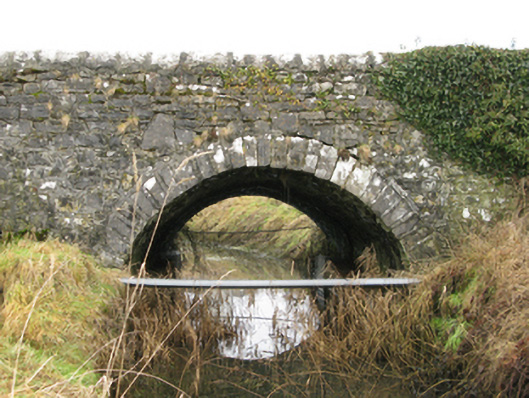
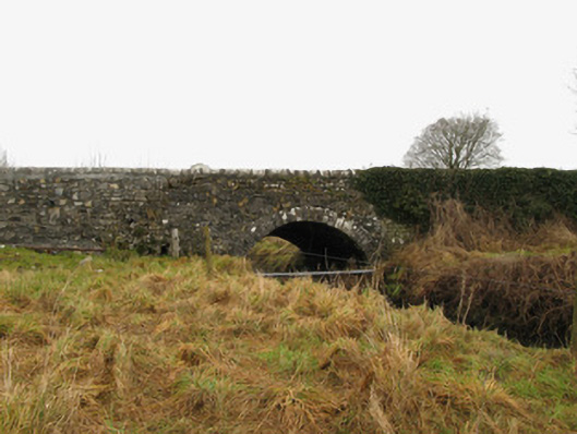
Description
Single-arch road bridge over lough, extant 1894. Part ivy-covered walls with repointed lichen-covered hammered limestone rounded coping to parapets. Single segmental arch with repointed cut-limestone voussoirs. Sited spanning Ballyglass Lough with unkempt banks to lough.
Appraisal
A bridge representing an integral component of the nineteenth-century civil engineering heritage of south County Mayo with the architectural value of the composition, one succeeding a lengthy bridge marked on the first edition of the Ordnance Survey (surveyed 1838; published 1839), suggested not only by the sheer limestone dressings demonstrating good quality workmanship, but also by the elegant "sweep" of the arch making a pleasing visual statement at a crossing over Ballyglass Lough: meanwhile, a discreet benchmark remains of additional interest for the connections with cartography and the preparation of maps by the Ordnance Survey (established 1824).