


Survey Data
Reg No
13402350
Rating
Regional
Categories of Special Interest
Architectural, Technical
Previous Name
New Bridge
Original Use
Bridge
In Use As
Bridge
Date
1680 - 1720
Coordinates
221441, 258608
Date Recorded
24/08/2005
Date Updated
--/--/--
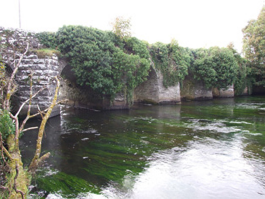
Description
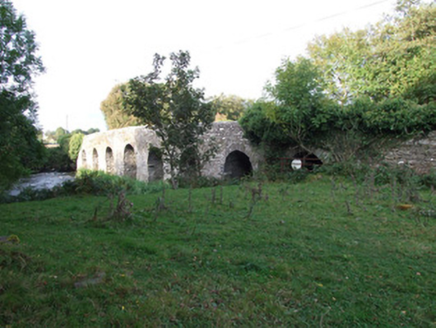
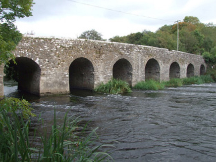
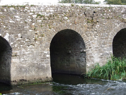
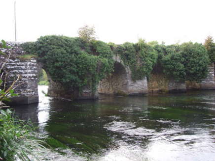
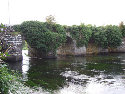
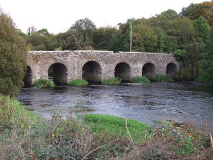
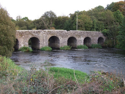
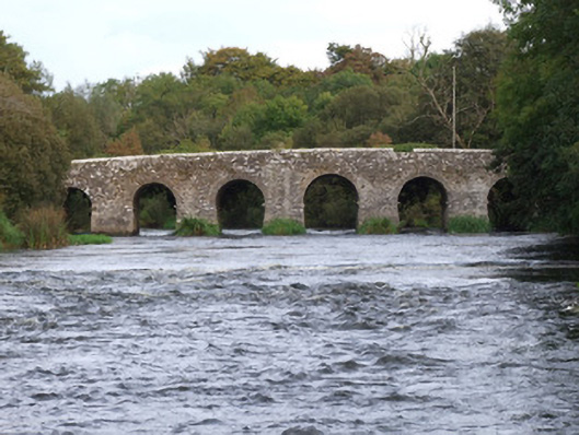
Nine-arch bridge carrying road over the River Inny, built c. 1700, having triangular-profile cutwaters to the east elevation (upstream). Semi-circular aches with roughly dressed limestone voussoirs to arches. Arch to south end now dry. Rubble stone construction to abutments, piers, barrels and spandrels. Rubble stone parapets with rounded coping over. Bridge rises gently to the centre. Rubble stone wing walls to parapet ends. Located to the northeast of Ballymahon, just to the north of Cloghan Mills (13402351), and to the west of Abbeyshrule.
Appraisal
This substantial and impressive road bridge is probably the earliest large-scale bridge in County Longford that exists in its early form. The large piers between the arches, which are of a similar size to the arches themselves, and the general form of this bridge, suggests that it dates to the end of the seventeenth century or the first decades of the eighteenth century. Dowdall (1682) records no bridge at this point although Piers writing two years later (1684) mentions a bridge at Tennalick, which may be this bridge. It is indicated as 'Clynan or New Bridge' on an 1838 map of the area (Ordnance Survey first edition six-inch map), which suggests that it may have replaced an earlier bridge on or close to this site (possibly upstream near the remains of the castle and later a corn mill at Tennalick). The location of this bridge, which is adjacent to the south of Tennalick House (13402348), hints that this bridge may have some connection with this important early building. The bridge is robustly-built using rubble stone masonry, and its survival for three hundred years is testament to the quality of its original construction. The triangular-profile cutwaters to the upstream elevation were built to protect the bridge from damage. The rock-faced masonry to a number of the cutwaters suggests that they were rebuilt c. 1860. The dry arch to the south end of the bridge indicates that the river was wider at this point when the bridge was originally constructed, and that the channel was later dredged as part of drainage works (probably during the mid-nineteenth century). This simple but elegant bridge is one of the more important historic bridges in County Longford, and is an integral element of the built heritage of the county.