


Survey Data
Reg No
12504200
Rating
National
Categories of Special Interest
Archaeological, Architectural, Historical, Social
Original Use
Fortification
Historical Use
Barracks
Date
1550 - 1580
Coordinates
247157, 198512
Date Recorded
29/08/2008
Date Updated
--/--/--
Description
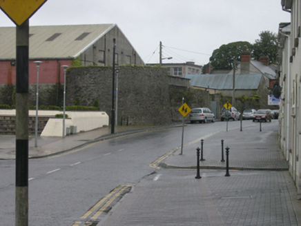
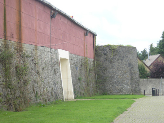
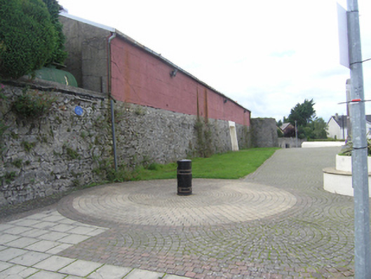
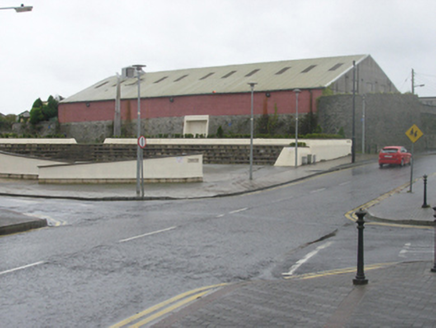
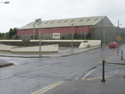
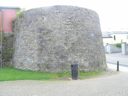
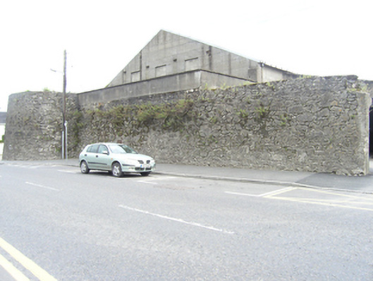
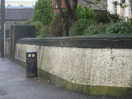
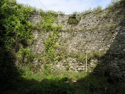
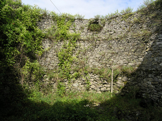
A square walled fort, built c. 1560, on rising ground south-west of the river Triogue, its outline enclosing about one hectare. It substantially survives and standing sections include most of the north and east walls and portions of the west and south wall with an impressive round bastion to the north-east corner. It is built of limestone rubble with a pronounced batter to the north wall, bastion and particularly evident on the shortened and rendered sections at the junction of Church Street and Railway Street. The round bastion is twelve metres in diameter, one and a half metres thick at the base and one metre at the top. A square tower at the south-west corner, illustrated in the late eighteenth-century views, no longer survives. The entrance was in the west wall, in the portion now missing along Railway Street. There is map evidence that there were substantial earthen ramparts inside the walls providing defence against artillery and a fighting platform. Its function as a fort was relatively short lived, the interior and possibly part of the defensive walls were dismantled by Colonel John Hewson in 1652-3 at the end of the Cromwellian wars. A 1721 map and the 1839 OS map indicate it contained barracks. New barracks were built to the south-west of Main Street in 1831. Gradually colonised during the course of the nineteenth and early twentieth-century, it is surrounded by the Catholic quarter on two sides, two schools were built within its circuit, in the south-east and north-west corners. The remaining section of the Odlum's Mills complex at the north-eastern corner is now a town council depot. There are also several houses and outbuilding within the fort. Sections of wall appear to have been incorporated into the garden boundary wall of two houses (12504197 & 12504198).
Appraisal
Built c. 1560, the outline of the fort and the settlement at Maryborough was recorded in a manuscript plan of c. 1563. It now contains two schools, several houses and gardens and part of a mill complex, underlining its size, and dominates the area north-east of Main Street. It has immense historical importance, Fort Protector at Maryborough and Fort Governor at Daingean (Co. Offaly) were integral elements in the plantation of the midlands in the sixteenth century. The fort at Daingean (Philipstown) no longer survives, adding to the importance of Maryborough Fort. It is the earliest historic structure surviving in the town and the historic centre of Portlaoise. The development within and around the fort show the evolution of the town and it forms an integral part of the character of Portlaoise.