
Survey Data
Reg No
12400502
Rating
Regional
Categories of Special Interest
Architectural, Technical
Original Use
Bridge
In Use As
Bridge
Date
1815 - 1835
Coordinates
253433, 171853
Date Recorded
19/10/2004
Date Updated
--/--/--
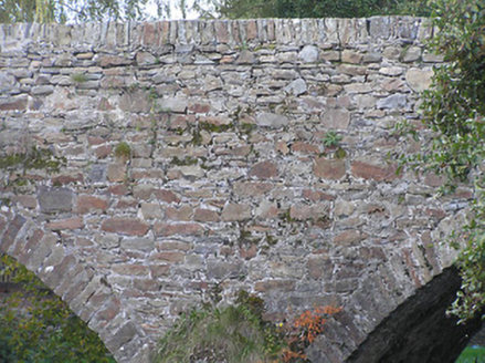
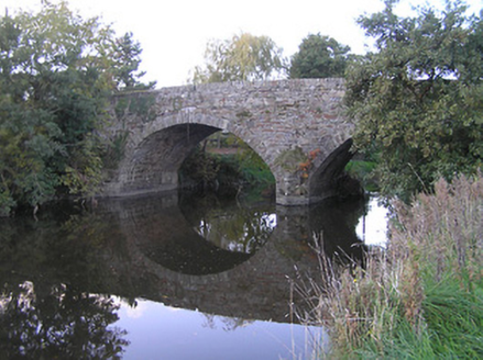
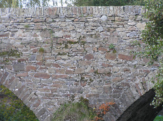
Description
Two-arch rubble stone hump back road bridge over river, c.1825. Random rubble stone walls with cut-stone triangular cut-water to pier, and squared rubble stone coping to parapets. Pair of segmental arches with squared rubble stone voussoirs, and rubble stone soffits having remains of render over. Sited spanning Dinin River with grass banks to river.
Appraisal
Making a picturesque impression at a crossing over the Dinin River a modest-scale bridge represents an important element of the early nineteenth-century civil engineering of Castlecomer and the environs. Exhibiting a traditional construction in locally-sourced rubble stone the bridge integrates pleasantly into the surrounding landscape.