
Survey Data
Reg No
12003049
Rating
Regional
Categories of Special Interest
Architectural, Scientific
Original Use
Gates/railings/walls
Date
1843 - 1871
Coordinates
250346, 156521
Date Recorded
27/07/2004
Date Updated
--/--/--
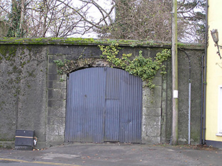
Description
Gateway, extant 1871, on a symmetrical plan comprising pair of benchmark-inscribed limestone ashlar piers framing camber- or segmental-headed carriageway with spalled red brick voussoirs. Now disused. Street fronted at entrance to grounds of Bishop's Palace.
Appraisal
A gateway making a pleasing visual statement in an urban street scene at an obsolete entrance on to the grounds of the Bishop's Palace estate: meanwhile, a benchmark remains of additional interest for the connections with cartography and the preparation of maps by the Ordnance Survey (established 1824).