

Survey Data
Reg No
50130011
Rating
Regional
Categories of Special Interest
Architectural
Previous Name
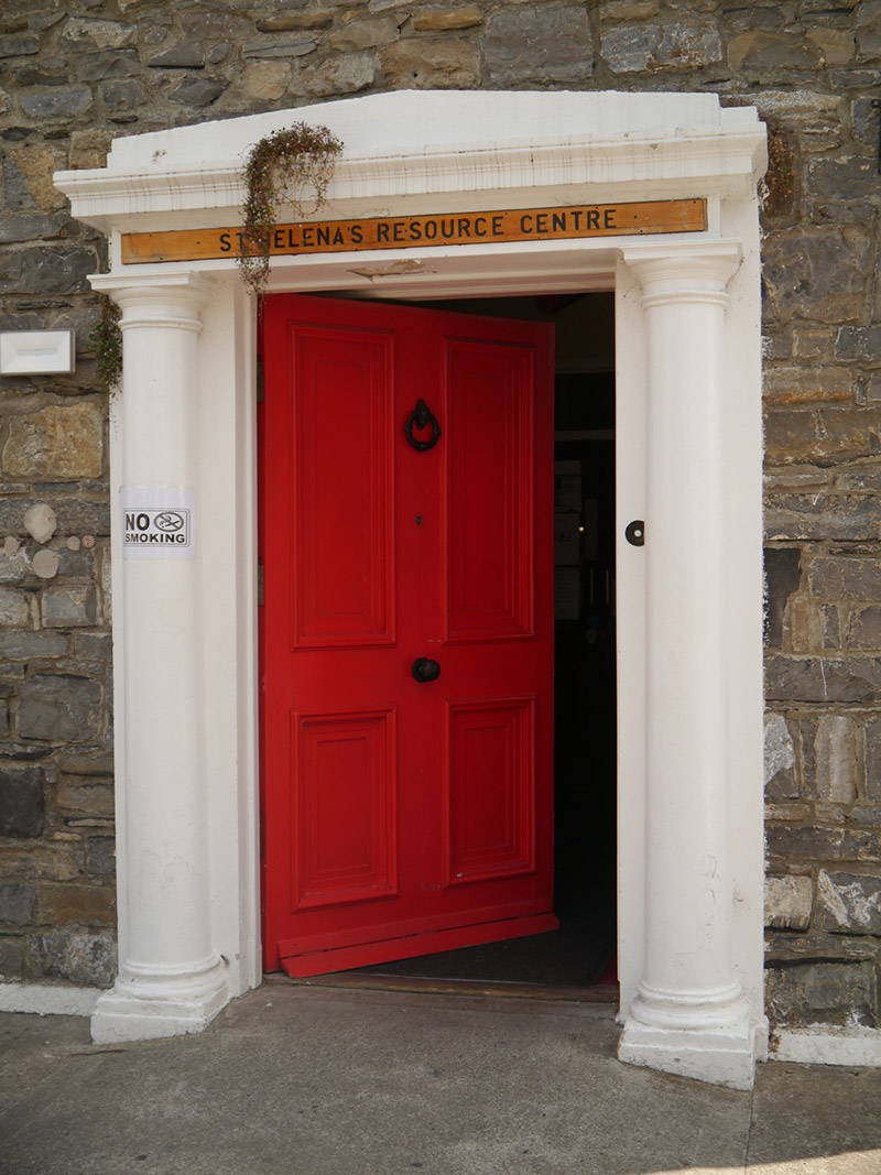
St. Helena's
Original Use
House
In Use As
Building misc
Date
1810 - 1830
Coordinates
313141, 238240
Date Recorded
19/07/2018
Date Updated
--/--/--
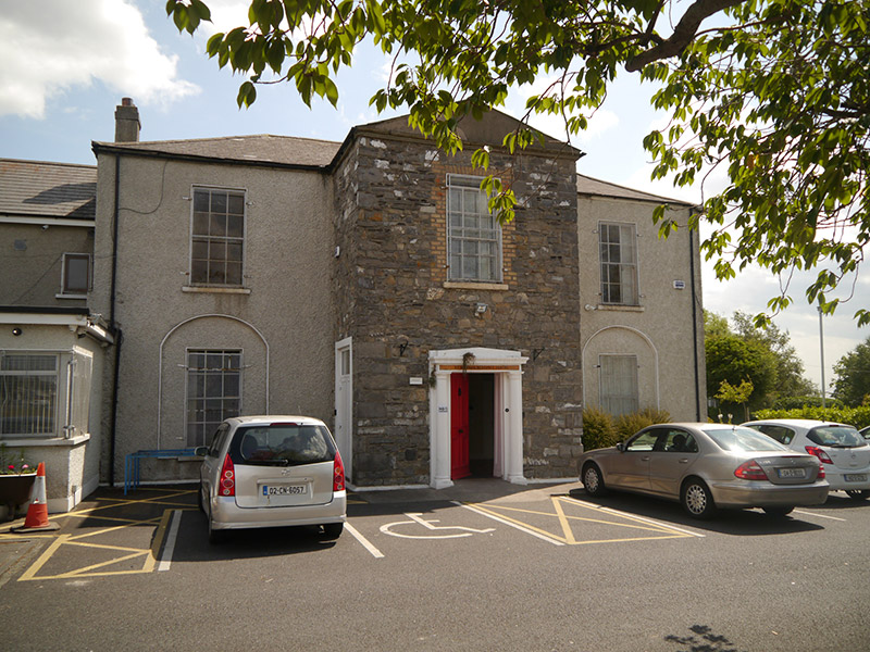
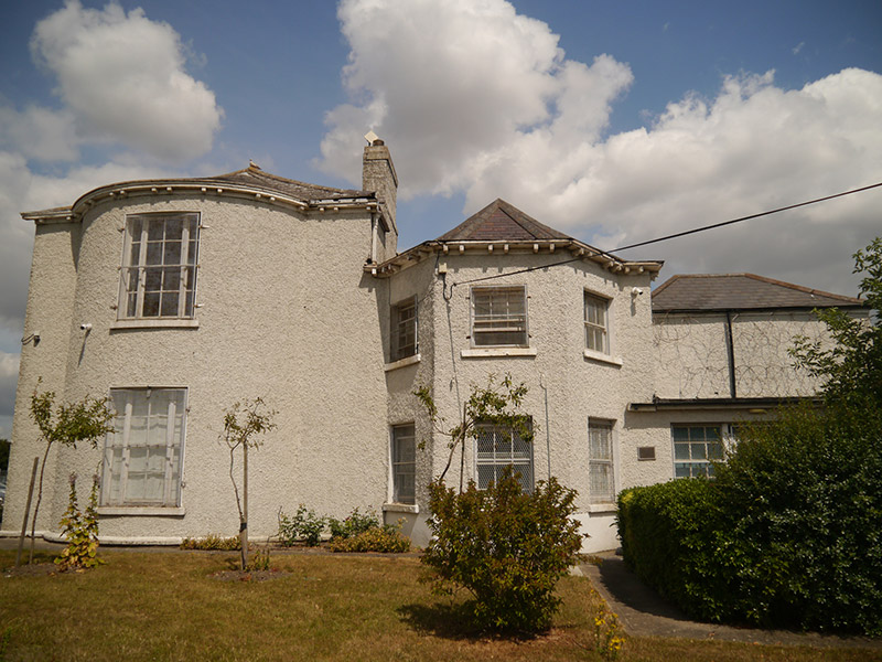
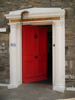
Description
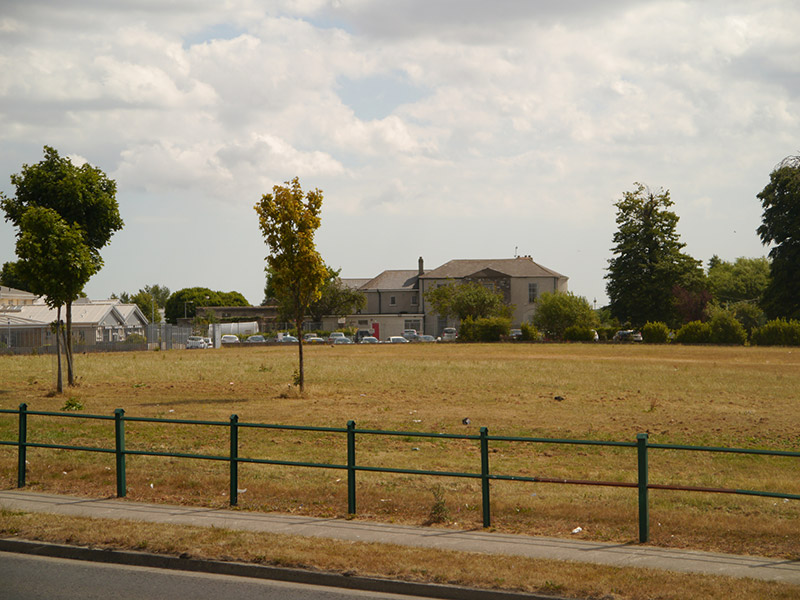
Detached three-bay two-storey square-plan former house, built c. 1820, having full-height projecting pedimented entrance projection, bowed end to south, lower parallel return having canted south end, and attached outbuildings to rear (east); contemporary extensions to north. Now in use as social care resource centre. Hipped slate roofs, having angled ridge tiles, clipped verges to west and slightly overhanging eaves with bracketed timber soffits to south; half-round cast-iron rainwater goods; rendered chimneystacks to north and east wall-heads. Generally painted roughcast rendered walling over smooth-rendered plinth; entrance projection with render removed and having squared-and-snecked quarry-faced limestone walling over narrow raked cement plinth; pediment rendered over projecting limestone band. Square-headed window openings generally having patent reveals and painted granite sills, front ground floor front openings set within segmental-headed recesses, first floor of projection having exposed stepped brick reveals and voussoirs, and generally six-over-six pane timber sliding sash windows, but with tripartite four-over-four pane windows to south elevation and three-over-three panes to south elevation of return. Square-headed entrance set in painted stucco surround comprising engaged Doric columns on moulded bases with cornice and raked blocking course, and having four-panel bolection-moulded timber door with cast-iron ironmongery. Square-headed replacement uPVC door inserted to north elevation of entrance projection. Roughcast rendered rubble stone wall forms eastern boundary of enclosed yard with two-storey slated and rendered outbuildings to north and south, accessed via recessed segmental-headed vehicular archway. Remains of walled garden to north, enclosed to west by red brick and random rubble wall with segmental recesses having red brick voussoirs and granite imposts.
Appraisal
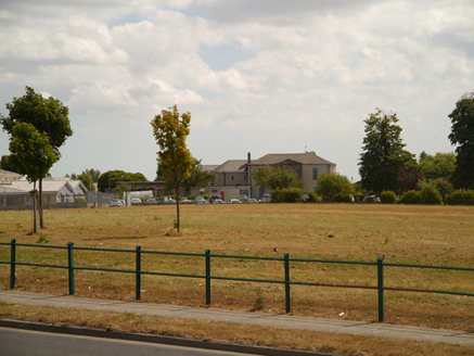
St. Helena's is an elegant and modestly proportioned early nineteenth-century house, shown on the OS map of 1837 within an extensive site of maturely planted grounds, with a straight planted avenue captioned 'The Long Walk' leading from the house to Finglas village to north. Despite a change of use, the building retains a high proportion of original fabric and features, including its Doric doorcase and timber sash windows. The exposed rubble stone entrance bay lends a homely texture to the more formal elements of the composition, which include a symmetrical plan and bowed end typical of its period. The building is enhanced by retention of various setting features, including the yard of outbuildings to the rear, coach entrance and the remains of an enclosed garden. The building provides architectural interest and historical context in an area that has otherwise been irrevocably altered by planned social housing developments of the mid- to late twentieth century.