
Survey Data
Reg No
50110276
Rating
Regional
Categories of Special Interest
Architectural, Artistic
Original Use
House
In Use As
House
Date
1830 - 1845
Coordinates
315383, 233105
Date Recorded
26/05/2017
Date Updated
--/--/--
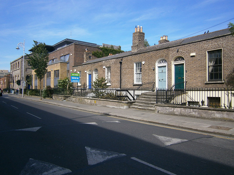
Description
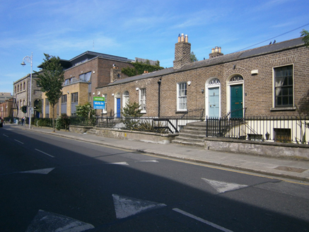
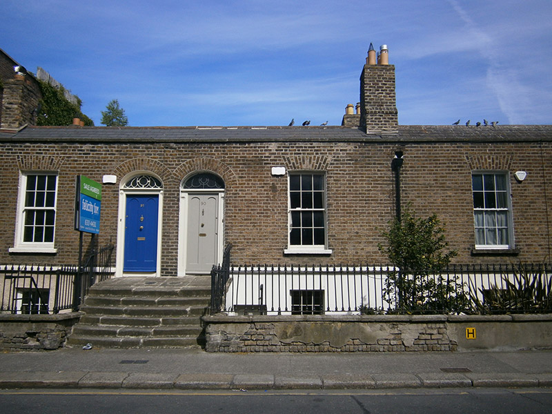
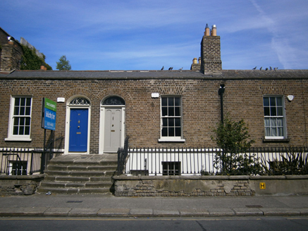
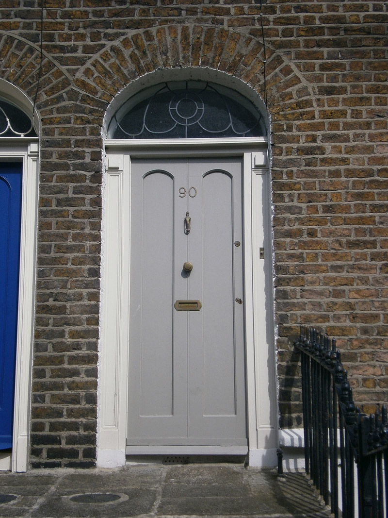
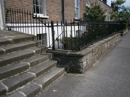
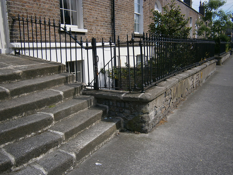
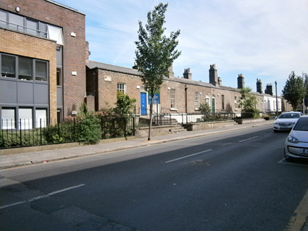
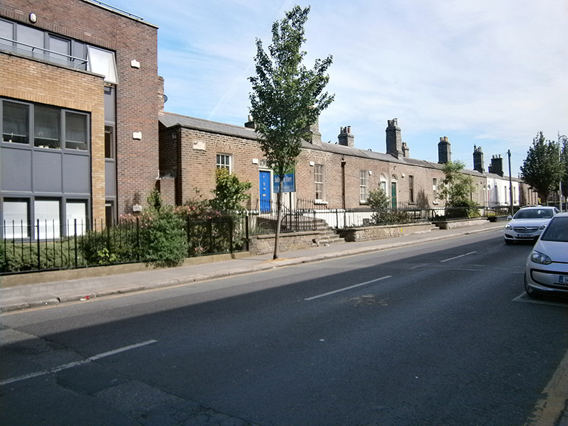
Terraced two-bay single-storey house over raised basement, built c. 1840, as one of terrace of eight. M-profile pitched slate roof having terracotta ridge tiles, shared brick chimneystacks, brick parapet with granite coping, and cast-iron rainwater goods. Red brick, laid in Flemish bond, to walls, having cut granite plinth course over lined-and-ruled rendered walls to basement. Square-headed window openings with granite sills, rendered reveals and six-over-six pane timber sliding sash windows. Elliptical-headed door opening having rendered reveal, timber doorcase comprising panelled pilasters and cornice. Timber panelled door and replacement fanlight. Shared granite steps with cast-iron bootscrape and coal-hole cover to platform. Basement area enclosed by rendered brick plinth wall having granite coping, surmounted by wrought-iron railings with decorative cast-iron collars. Half-height matching gate to basement. Square-headed basement doors beneath entrance steps. Set back from road, with basement-level front garden.
Appraisal
This house retains its facade composition, with salient features, including its door, windows and ironmongery, which are characteristic of its mid-nineteenth century date. The shared scale and features of the terrace contribute to the unified residential neighbourhood character of the locality. The elegant ironwork attests to the quality and artisanship in the mass production of nineteenth-century metalwork. Heytesbury Street forms part of an early Victorian neighbourhood located to the west of Camden Street. These small genteel townhouses are a unique typology to Dublin and served as homes for the lower middle classes in the city. Heytesbury Street, named after Baron Heytesbury, Viceroy 1844-6, was first laid out in 1846 and was nearing completion by 1861. This group of houses had already been begun and is depicted on what was then New Bride Street on the first edition Ordnance Survey map of 1838. The terrace of buildings is historically called 'BellVilla Heytesbury' as named on the plaque on the facade of No. 91.