
Survey Data
Reg No
50060300
Rating
Regional
Categories of Special Interest
Social, Technical
Original Use
Weir
In Use As
Weir
Date
1770 - 1830
Coordinates
310089, 234636
Date Recorded
29/09/2014
Date Updated
--/--/--
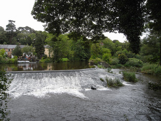
Description
Rubble stone weir, built c.1800, set on curve across River Liffey, with rubble stone sluice to north end, with some cogged iron wheels retained.
Appraisal
The weir is shown on the 6 inch first edition OS map surveyed in 1837. It could be older than dated in record. Although the structure is not clearly visible, the water formation caused by it has much aesthetic appeal with still water following the curve of the weir, and gentle rapids downstream. As a notable landscape feature the weir is a reminder of the industrial heritage of Chapelizod village and part of a greater collection of historic structures along the course of the Liffey.