


Survey Data
Reg No
40852078
Rating
Regional
Categories of Special Interest
Historical, Scientific, Technical
Original Use
Bollard
Date
1825 - 1860
Coordinates
187693, 361260
Date Recorded
23/10/2007
Date Updated
--/--/--
Description
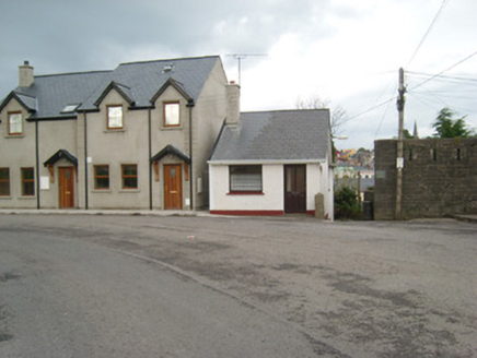
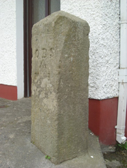
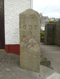
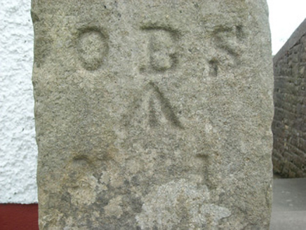
Cut stone post on square-plan having pyramidal-head, erected c. 1835, having Ordnance Survey benchmark and incised letter. Carved from granite (?) with incised lettering ‘O B S’ and ‘No. 1’ with incised benchmark between to the south face. Located adjacent to flight of steps leading down to Westport, and adjacent to the west of the remains of The Rock Barracks (40852077). Located to the south of Ballyshannon town centre.
Appraisal
This simple artefact of street furniture is an interesting addition to the streetscape of Ballyshannon. The incised benchmark and lettering suggests that it was originally erected by the Ordnance Survey, which published the first edition of the six-inch map series for County Donegal in 1836. It is unusual in that it is a freestanding post as benchmarks were much more commonly incised into the corners of buildings such as churches and bridges etc. Such benchmarks are also known as ‘sappers marks’. However, it may also be an ordnance boundary post associated with the adjacent barracks (40852077). It is an interesting and well-preserved example of street furniture that has survived in a changing area of the town, as shown by the modern housing developments to the south and south-east. It is of technical and scientific interest as evidence of the Ordnance Survey mapping of Ireland in the 1830s, and is a subtle addition to the built heritage of Ballyshannon.