


Survey Data
Reg No
40852063
Rating
National
Categories of Special Interest
Archaeological, Architectural, Historical
Original Use
Barracks
In Use As
Public house
Date
1695 - 1705
Coordinates
187718, 361411
Date Recorded
26/10/2007
Date Updated
--/--/--
Description
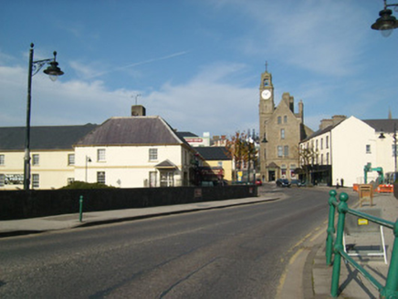
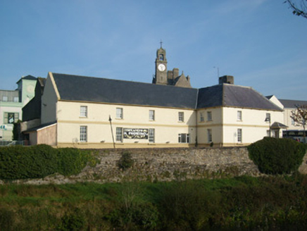
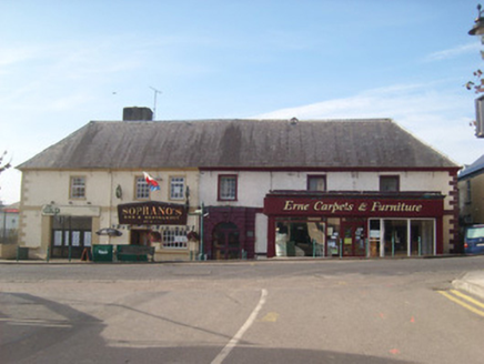
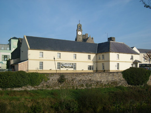
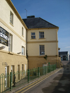
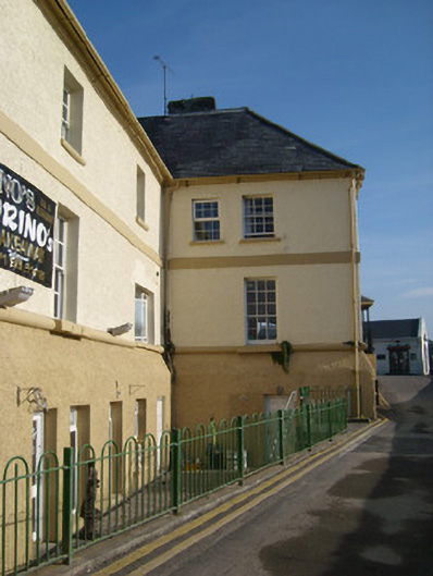
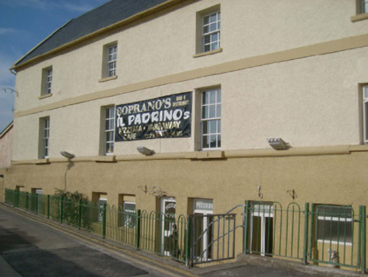
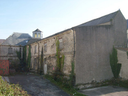
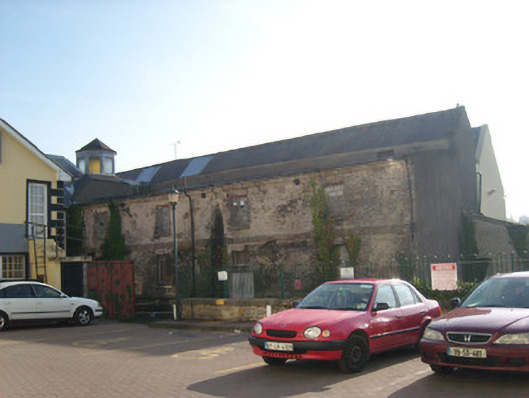
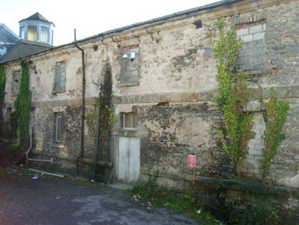
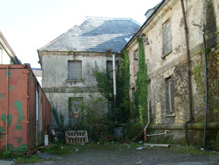
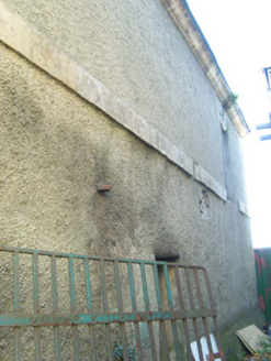
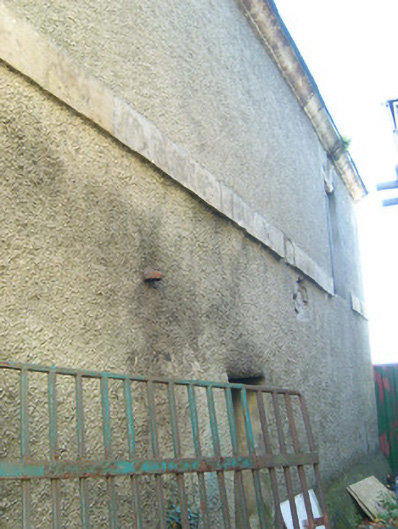
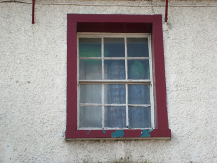
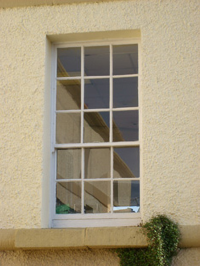
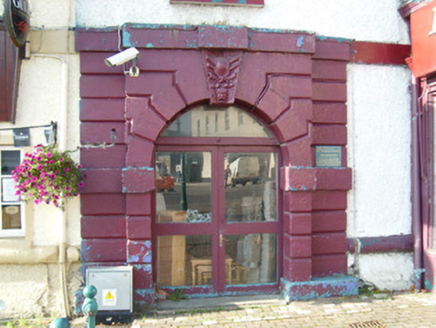
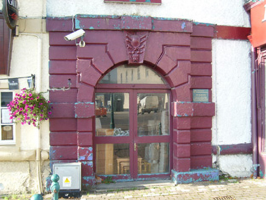
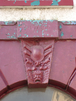
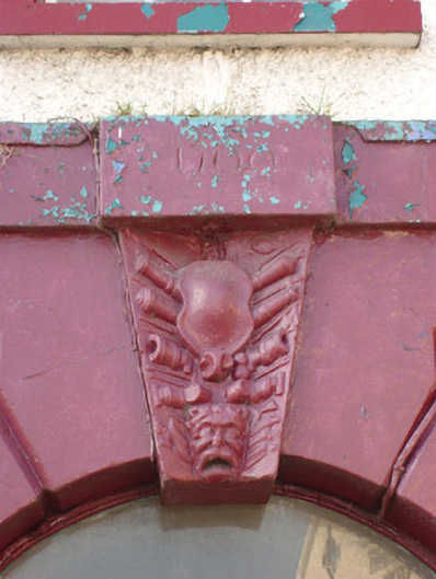
Detached six-bay two-storey (formerly five-bay) over concealed basement former infantry barracks on T-shaped plan, dated 1700 and altered c. 1753-6 and c. 1765, having two adjoining four-bay two-storey over basement returns to the rear (west). Lantern rooflight on octagonal-plan having hipped roof over to the rear of main block; single-bay single-storey lean-to outbuilding to the rear (west) of rear return. Rear return derelict to the north elevation. Later in use as a shirt factory. Building now subdivided into various units (shops, offices, pub/restaurant and accommodation) with projecting single-storey flat-roofed retail outlet to the north end of the main elevation (east) and various extensions to the rear. Steeply pitched hipped natural slate roof to front block (east) having rendered chimneystack to the south of centre, rolled lead to ridge, cast-iron rainwater water goods and pronounced cyma recta ashlar eaves course (painted to front elevation); pitched artificial (fibre cement) roof to rear return having raised coping to the south end. Corrugated cement roof to the rear return, rear elevation. Roughcast rendered walls with battered roughcast rendered plinth, and having flush ashlar/torus course between ground and first floor levels and a pulvinated stringcourse/sill course at ground floor level to main (east) and south elevations; pulvinated stringcourse to north elevation at ground floor level below sill level. Cut stone block-and-start quoins to the corners of the front elevation. Square-headed window openings having cut stone two- or three stone sills and replacement nine-over-six pane timber sliding sash or modern window fittings at ground floor level (south elevation) and six-over-six pane timber sliding sash or modern window fittings at first floor level; plain raised render surrounds to first floor openings to front elevation (east); modern window and door openings at ground floor level to front elevation (east); modern window and door fittings to south elevation of rear return at basement level; openings to north elevation of rear return infilled with cavity block or having modern fittings, some retaining stone surrounds. Round-headed door opening to the centre of the main elevation (east), set in projecting channelled ashlar stone surround having projecting ashlar plinth, projecting ashlar stringcourse at arch springing point level, projecting keystone decorated with cannon, arms, shield and head motifs, and having date stone over incised ‘1700’. Modern glazed timber doors and overlight. Modern offices and pub/restaurant fronts to main elevation (east), c. 2000, with projecting flat-roof rendered shopfront to the north end, c. 1960; and having variety of replacement fittings to modern window and door openings, some enlarged. Groin vaulted spinal corridor runs length of building from main doorway to the east; a number of lugged timber architraved surrounds to interior doors and to windows apparently insitu; and some timber panelling survives to a number of the rooms (interior not viewed, information from 1997 survey). Set back slightly back from road adjacent to Ballyshannon Bridge (40852064) on the north bank of the River Erne, and to the south end of Main Street. Modern plinth wall and railings to basement level to the south elevation; modern boundary walls and railings to rear of site.
Appraisal
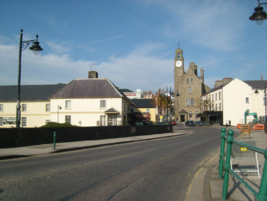
This important and imposing former infantry barracks is one of the oldest surviving examples of its type still extant in Ireland. It survives in relatively good condition, despite some alterations and additions (mainly) to the front elevation – and its division into multiple properties - and its original form and architectural character are still easily discerned. The good quality channelled stone surround to the main doorway, which is of artistic merit, provides a central focus and helps give this building an air of authority that befits its original military function, while the cannon and arms motifs to the keystone are indicative of its original use. The pulvinated frieze, plain stringcourse and the pronounced ashlar cyma recta eaves course add further interest to an otherwise plain front elevation with distinctive The proportions to the front elevation having been adversely affected by the insertion of modern window and door openings, and by the projecting shopfront to the north end of the main elevation. The battered plinth is an interesting feature that is sometimes found on early buildings such as this, while the steeply pitched roof to the main block is a distinctive feature that also indicates the antiquity of this structure, and helps create an interesting and varied roofscape to the south end of Main Street. This building was originally built to guard an important crossing/fording point over the River Erne (close to the mouth of the river and site of an earlier ford) and close to an important natural harbour, and represents one of the most strategic locations in Ulster (which is probably why the town of Ballyshannon developed here in the first place). Control of this location effectively bestowed control of the main route from Connacht to Tirconnell/Donegal, and this location witnessed military action on multiple occasions throughout the medieval and post medieval periods (including during the Nine Years War (1594 - 1603). This barracks is apparently built on or close to the site of an earlier castle built by the O’Donnells in 1423. This O’Donnell castle was later demolished in the early seventeenth century by Sir Henry Folliott who built a new fortification on this site. The barracks at Ballyshannon is dated 1700 but the original designer/architect is not known. It was presumably built to designs by either Sir William Robinson (1645 - 1712) or his successor as Surveyor General in Ireland Colonel Thomas Burgh (1670 - 1730), who both served in the position in 1700. Burgh is considered by Craig (1982) to be ‘the first indisputably and unmistakably Irish architect’, and if Ballyshannon Barracks is by Burgh it would represent probably his earliest building in the role as Surveyor General, predated the Royal Barracks (now Collin’s Barracks), built 1701-4. Burgh was appointed ex-officio Barracks Overseer in Ireland in 1701, and from 1705 until 1714 also held the post of Lieutenant of the Ordnance of Ireland so he would have been very familiar with this barracks in Ballyshannon. However, this barracks was, perhaps, more likely to have been designed by Robinson (it was attributed to Robinson by Loeber writing in 1760 – Barrack Commissioners Report). who served in the role from 1670/1 until 1700, a role he shared with William Molyneaux (1656 - 1698) from 1684 - 1698. It was apparently was built at the sole expense of Mr [William] Connolly (Loeber 1760), a local man who became the richest man in Ireland during the early eighteenth century and built Castletown House in County Kildare, begun in 1722. An account of Ballyshannon from 1739 records ‘along the shore of the river stands beautifully two very fine barracks, that on the west side of the street for two companies of foot, the other on the east for two troops of horse [on site of the market place/yard to the east of the infantry barracks; ruinous by 2014 and demolished by 1836]. The 14th (King’s) Hussars were stationed here regularly in the 1730s. However the barracks had apparently become largely derelict by c. 1760, being ‘neglected to fall into ruin, insomuch, that excepting the outside walls of the building will require and entire repair (Loeber 1760). However, works were apparently carried out at the barracks between 1753-6 under the direction of Michael Priestly (died 1777), an architect who also designed Lifford Courthouse between 1746-1754, and again in 1765 supervised by James Dickson (IAA). The barracks had four companies of infantry stationed here in 1811, and was described in 1833 as ‘this noble structure is delightfully situated on the banks of the Erne, at the northern extremity of the bridge. It is at present occupied by two detachments of the 27th Regiment…. only a few months arrived here’ (unknown author). The barracks was also put forward as a potential workhouse during the 1840s, prior to the construction of the purpose-built workhouse (40852075 and 40852076) to the south of the town, suggesting that the barracks was not in use at this time (Begley 2009). However, Slater’s Directory of 1846 suggests that it was still in use as an infantry barracks at this time, when it was ‘generally occupied by an infantry regiment’. It formerly was surrounded by a wall with a gatehouse (?) to the centre of the front elevation (east) – Ordnance Survey first edition six-inch map sheet 1836. In the late-nineteenth century, it was leased for use as a shirt factory run by Tillie and Henderson Company of Derry. This notable building is an important element of the built heritage and social history of Ballyshannon. Sensitively restored back to its original form, it would represent one of the more important buildings of its type in Ireland.