

Survey Data
Reg No
40829006
Rating
Regional
Categories of Special Interest
Architectural, Scientific, Technical
Original Use
Bridge
In Use As
Bridge
Date
1780 - 1820
Coordinates
213356, 409424
Date Recorded
10/11/2010
Date Updated
--/--/--
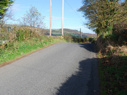
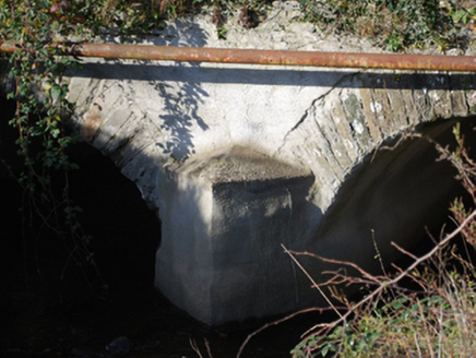
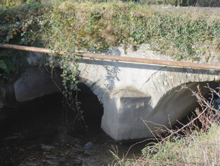
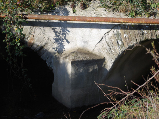
Description
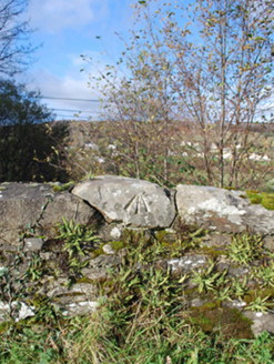
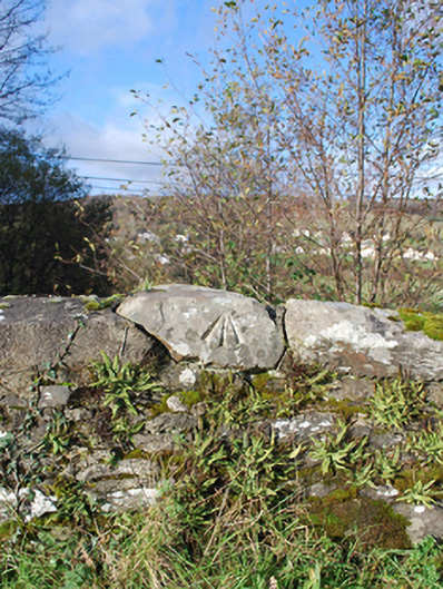
Double-arched bridge carrying road over Roughan River, built c. 1800, having V-profile cement rendered rubble stone cutwater to the central pier to both upstream and downstream elevations. Bridge rises from either end to centre creating slightly hump-backed from. Segmental-headed arches having dressed cut stone voussoirs; cement rendered rubble stone construction to the arch barrels. Cement rendered random rubble stone construction to pier, spandrels, and parapets. Rubble stone and rendered coping to parapet. Ordnance Survey benchmark to coping stone to parapet. Modern utility pipe to the south elevation. Tarmacadam deck with grass verges. Located in the rural countryside to the south-west of Letterkenny.
Appraisal
Despite some modern alterations, this simple but appealing double-arched road bridge retains much its early character and form, and is an appealing feature in the rural landscape to the south-west of Letterkenny. This bridge is robustly-constructed in local rubble stone masonry, and its continued survival and use stands as testament to the quality of its original construction, and of the skill of the masons involved. The slightly hump-backed form of this bridge, and the form of the arches, suggests that this bridge may date to the second half of the eighteenth century, a period that witnessed a large expansion in the rural road network in Ireland (and the subsequent building of numerous bridges), which was mainly carried out by the Grand Juries (the forerunners of the County Councils). The cutwaters are an interesting feature. Although recent cement rendered, this bridge is an integral element of the built heritage and transport heritage of the local area, and makes a positive contribution to the landscape. The bench mark to a coping stone to one of the parapets is an interesting reminder of the work by the Ordnance Survey in the compilation of the first edition six-inch maps of the country in the 1830s, and adds some modest scientific merit.