

Survey Data
Reg No
20821003
Rating
Regional
Categories of Special Interest
Architectural, Historical, Social
Previous Name
Fermoy Military Hospital
Original Use
Hospital/infirmary
Date
1810 - 1820
Coordinates
181026, 99372
Date Recorded
16/08/2006
Date Updated
--/--/--
Description
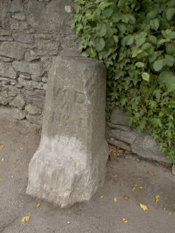
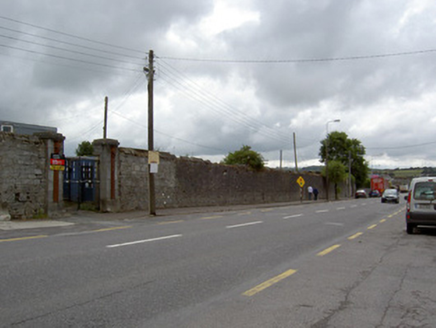
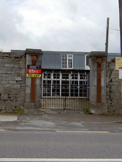
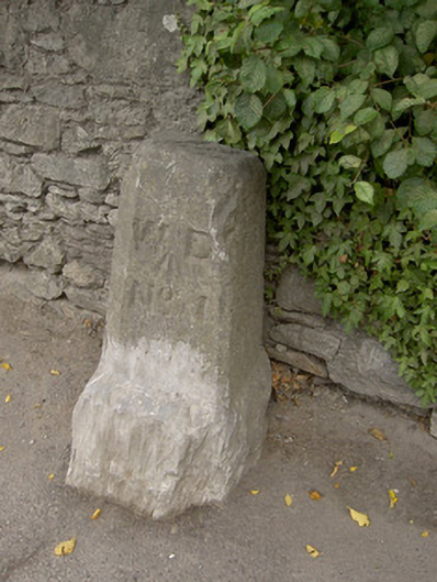
Freestanding rubble limestone boundary walls, built c. 1815, formerly forming south-west perimeter of military hospital. Cut limestone coping survives to some parts. Pair of dressed limestone square-profile piers to north end, having dressed limestone plinths and caps, with attached fluted pilasters having capitals. Recent cast-iron double-leaf gates. Square-headed pedestrian entrance to south with red brick surround, dressed limestone lintel and step. Dressed limestone square-profile piers to south with dressed limestone plinths and simple caps. Freestanding rectangular-profile cut limestone Ordnance boundary stone to south end of wall, with chamfered edges to front face and incised lettering. Set against rubble limestone boundary wall.
Appraisal
These tall walls form a distinctive feature on the Oliver Plunkett streetscape. They were formerly the boundary walls of the military infirmary, which served the barracks to the south. The finely carved piers survive and demonstrate the importance and grandeur of the site in former times. They also show the craftsmanship of the late eighteenth and early nineteenth centuries, forming a group with the barracks complexes to the south. The War Department boundary stone is significant as highlighting the military background to the boundary wall. Fermoy was an important garrison town in the nineteenth and early twentieth centuries and this marker is an interesting physical reminder of this military history.