Survey Data
Garden No.
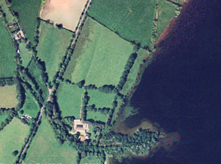
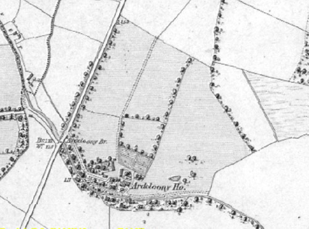
3682
Townland
Ardcloony
Present on Ordnance Survey
First Edition: Yes, sheet 134
Second Edition: Yes, house shown, parkland not indicated
Revised Edition: Yes, house shown, parkland not indicated
Garden No.
3682
Townland
Ardcloony
Present on Ordnance Survey
First Edition: Yes, sheet 134
Second Edition: Yes, house shown, parkland not indicated
Revised Edition: Yes, house shown, parkland not indicated
| Overview | |
|---|---|
| Site Footprint Visible | Yes |
| Boundary Defined | Yes |
| Significant Development | Yes |
| General Comments | The river Shannon has been dammed since to 1836 - 1846 OS survey was conducted and the resultant lake has flooded part of this site. |
| Architectural Features | |
|---|---|
| Principal Building | Yes |
| Garden Building | No |
| Buildings of Indeterminate Purpose | No |
| Gateways and Gatehouses | No |
| Avenues, Drives and Walks | |
|---|---|
| Avenue | No |
| Drive or Walk | No |
| Garden Features | |
|---|---|
| Ornamental Garden | No |
| Walled Garden | No |
| Orchard | No |
| Parkland | No |
| Woodland | Yes |
| Natural Water Feature | No |
| Artifical Water Features | No |
| Allée | No |
| Vista | No |
| Other | No |