

Survey Data
Reg No
15604024
Rating
Regional
Categories of Special Interest
Architectural, Scientific, Technical
Original Use
Bridge
In Use As
Bridge
Date
1700 - 1840
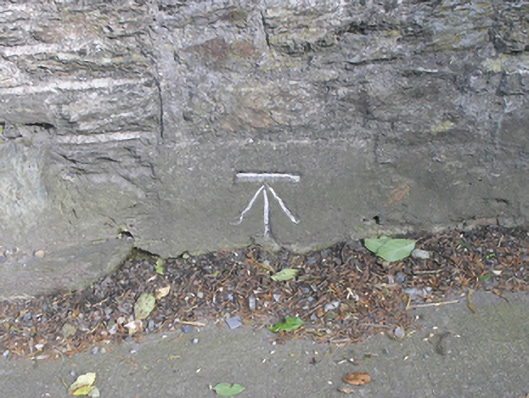
Coordinates
296942, 138918
Date Recorded
13/06/2005
Date Updated
--/--/--
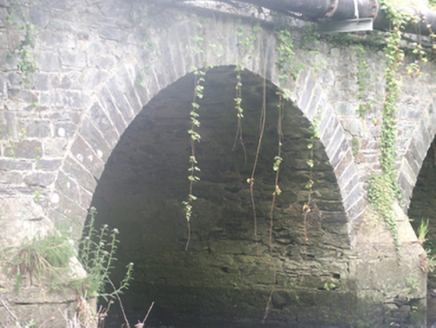
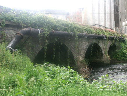
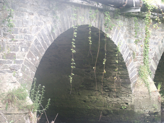
Description
Three-arch road bridge over river, extant 1840. Part creeper- or ivy-covered coursed rubble limestone walls centred on rounded triangular cutwaters to piers having domed pyramidal capping with stringcourses supporting parapets having hammered limestone soldier course coping. Series of three round arches with lichen-spotted limestone ashlar voussoirs. Sited spanning Urrin River with unkempt banks to river.
Appraisal
A bridge representing an integral component of the civil engineering heritage of County Wexford with the architectural value of the composition suggested not only by the limestone dressings demonstrating good quality workmanship, but also by the elegant "sweep" of the arches making a pleasing visual statement at a crossing over the Urrin River: meanwhile, a benchmark remains of additional interest for the connections with cartography and the preparation of maps by the Ordnance Survey (established 1824).