
Survey Data
Reg No
15602071
Rating
Regional
Categories of Special Interest
Architectural, Technical
Original Use
Unknown
In Use As
Unknown
Date
1719 - 1839
Coordinates
291179, 156823
Date Recorded
14/06/2005
Date Updated
--/--/--
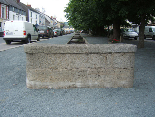
Description
Channelled stream, extant 1839, on an elongated plan between lichen-spotted cut-granite kerbed retaining walls centred on paired cut-granite slab footbridges; granite ashlar culvert screens having lichen-spotted cut-granite coping.
Appraisal
A lime tree-lined channelled stream representing an important component of the built heritage of Bunclody. NOTE: Variously cited as the centrepiece of a "new town" planned by the Maxwells of Woodfield [Newtownbarry House] or 'the idea of the late [Robert Westley] Hall-Dare to have an abundance of water for household purposes conveyed through the street in this manner' (Bassett 1885, 345).