
Survey Data
Reg No
15606003
Rating
Regional
Categories of Special Interest
Architectural, Scientific
Original Use
Granary
Date
1700 - 1840
Coordinates
273330, 127967
Date Recorded
21/06/2005
Date Updated
--/--/--
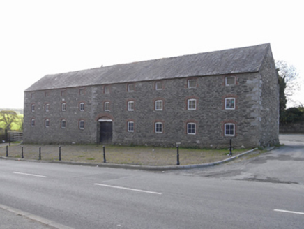
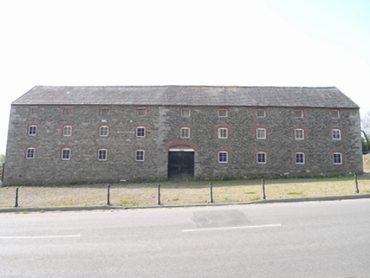
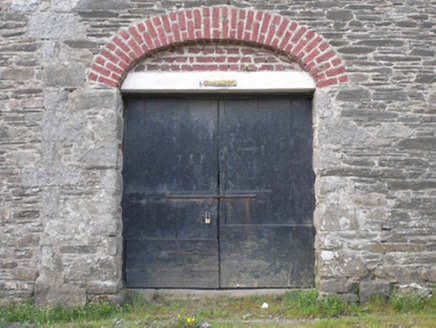
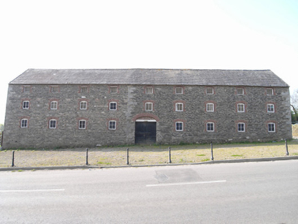
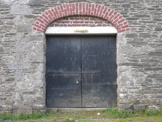
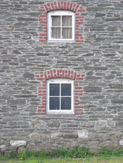
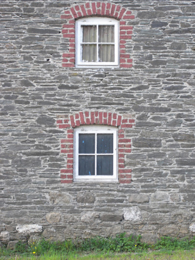
Description
Detached nine-bay three-storey grain store or warehouse, extant 1840, on a rectangular plan originally four- or five-bay three-storey. Now disused. Pitched slate roof with clay ridge tiles, lichen-spotted coping to gables, and no rainwater goods surviving on slate flagged eaves. Part creeper- or ivy-covered coursed rubble stone battered walls with benchmark-inscribed rough hewn granite flush quoins to corners; lime rendered surface finish to side (east) elevation. Square-headed central carriageway in elliptical- or segmental-headed recess with timber beam lintel framing timber boarded double doors. Square-headed window openings in camber-headed recesses with red brick block-and-start surrounds framing timber casement windows. Set back from line of road with verge to front.
Appraisal
A grain store or warehouse representing an important component of the industrial heritage of the outskirts of New Ross with the architectural value of the composition, one most likely erected in support of a diagonally opposing mill marked on the first edition of the Ordnance Survey (surveyed 1840; published 1841), confirmed by such attributes as rectilinear plan form; the somewhat disproportionate bias of solid to void in the massing compounded by the uniform or near-uniform proportions of the openings on each floor; and the high pitched roofline: meanwhile, a pronounced masonry break clearly illustrates the continued linear development of the grain store or warehouse. A prolonged period of neglect notwithstanding, the elementary form and massing survive intact together with substantial quantities of the historic or original fabric, both to the exterior and to the utilitarian interior, thus upholding the character or integrity of a grain store or warehouse making a pleasing visual statement in a rural street scene: meanwhile, a benchmark remains of additional interest for the connections with cartography and the preparation of maps by the Ordnance Survey (established 1824).