


Survey Data
Reg No
15603148
Rating
Regional
Categories of Special Interest
Architectural, Technical
Original Use
Malt house
Date
1880 - 1885
Coordinates
297244, 139991
Date Recorded
13/06/2005
Date Updated
--/--/--
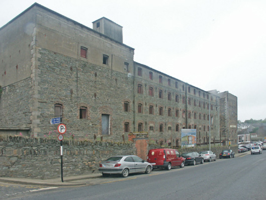
Description
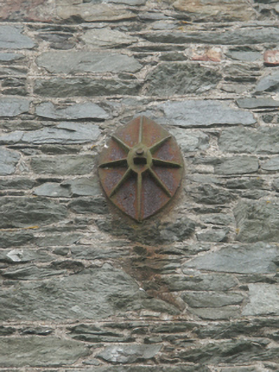
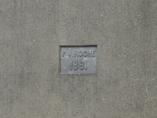
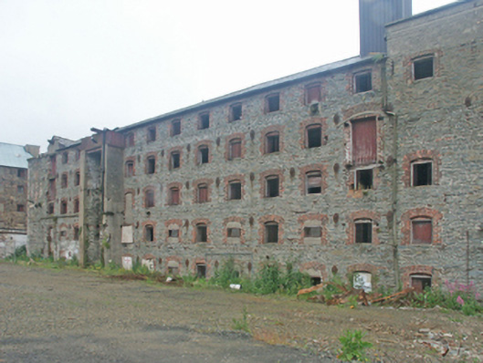
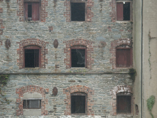
Detached seventeen-bay five-storey malthouse, dated 1881, on a rectangular plan. Now disused. Hipped slate roof on collared timber construction with clay ridge tiles, and cast-iron rainwater goods retaining cast-iron downpipes. Part repointed coursed rubble stone walls with benchmark-inscribed cut-granite flush quoins to corners centred on cast-iron "Pattress" tie plates; rendered surface finish (top floor). Square-headed window openings in camber- or segmental-headed recesses centred on tooled cut-limestone shield date stone ("1881") with red brick block-and-start surrounds framing timber boarded fittings behind wrought iron bars. Set back from line of street with boundary wall to perimeter having rubble stone soldier course coping.
Appraisal
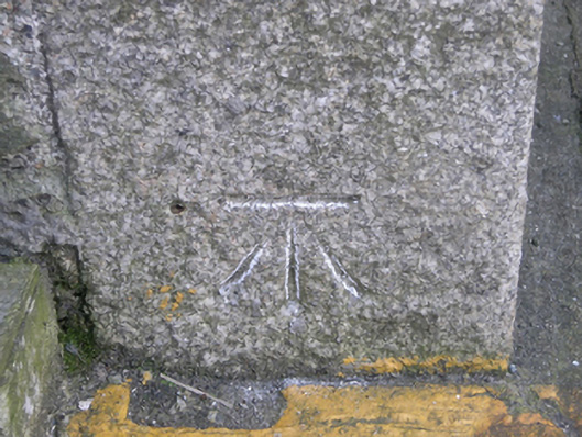
A malthouse erected by Patrick James Roche (1818-1905) of Woodville House (see 15702908) representing an important component of the later nineteenth-century industrial heritage of Enniscorthy with the architectural value of the composition confirmed by such attributes as the elongated rectilinear plan form; the construction in an unrefined local fieldstone offset by silver-grey granite or red brick dressings producing a pleasing palette; and the uniform or near-uniform proportions of the openings on each floor. A prolonged period of neglect notwithstanding, the elementary form and massing survive intact together with substantial quantities of the original fabric, both to the exterior and to the interior: however, a projected "restoration" may determine the ongoing architectural heritage status of a malthouse forming part of a self-contained ensemble (including 15603147; 15603149) making a pleasing visual statement overlooking the River Slaney: meanwhile, a benchmark remains of additional interest for the connections with cartography and the preparation of maps by the Ordnance Survey (established 1824).