
Survey Data
Reg No
22815006
Rating
Regional
Categories of Special Interest
Architectural, Scientific, Technical
Original Use
Bridge
In Use As
Bridge
Date
1810 - 1830
Coordinates
250739, 102657
Date Recorded
12/06/2003
Date Updated
--/--/--
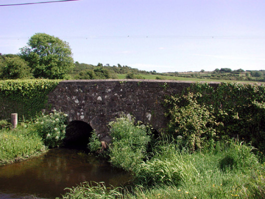
Description
Two-arch rubble stone road bridge over stream, c.1820. Random rubble stone walls with rubble stone parapets having rendered coping. Pair of round arches with cut-stone voussoirs, and squared rubble stone soffits having traces of render over. Sited spanning Annestown Stream with grass banks to stream.
Appraisal
An attractive bridge that presents a picturesque feature on Annestown Stream, and which forms one of a small group of bridges on that stream. The rubble stone work serves to integrate the bridge into the surrounding landscape, while the civil engineering heritage significance of the site is identified by the construction of the arches, which have retained their original profile.