
Survey Data
Reg No
22124010
Rating
Regional
Categories of Special Interest
Architectural, Social, Technical
Original Use
Well
Date
1780 - 1820
Coordinates
193211, 112927
Date Recorded
22/06/2005
Date Updated
--/--/--
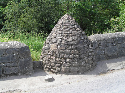
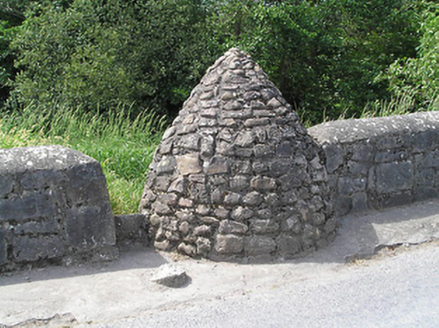
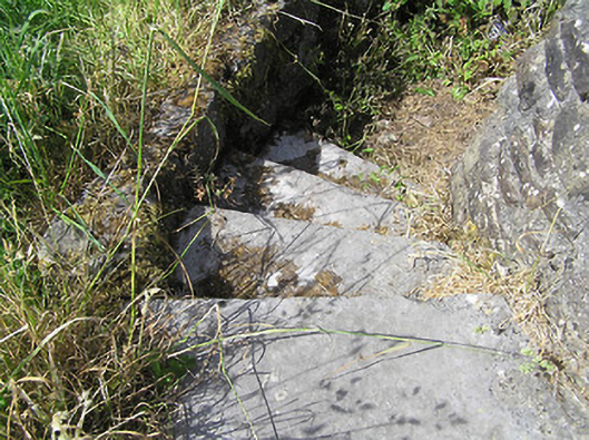
Description
Circular-plan covered well, built c. 1800, comprising pointed corbelled rubble sandstone roof set into south end of west parapet of Ballyporeen Bridge, with stile with limestone threshold leading to dressed limestone steps with rendered parapet wall, leading down well. Square-headed opening to well, having recent concrete lintel. Now disused.
Appraisal
The simple form of this structure reflects its functional nature, and the corbelling technique used in its construction is long established in Ireland. It creates an interesting contrast to the more formally planned and executed bridge to the north. Wells once played an important social and functional role in the nineteenth and twentieth centuries providing a communal water source. Situated prominently on Bridge Road, the well serves today as a reminder of this era and adds visual interest to the southern approach road to Ballyporeen.