

Survey Data
Reg No
41303056
Rating
Regional
Categories of Special Interest
Architectural, Technical
Original Use
Lock keeper's house
Date
1835 - 1845
Coordinates
268080, 333854
Date Recorded
14/10/2011
Date Updated
--/--/--
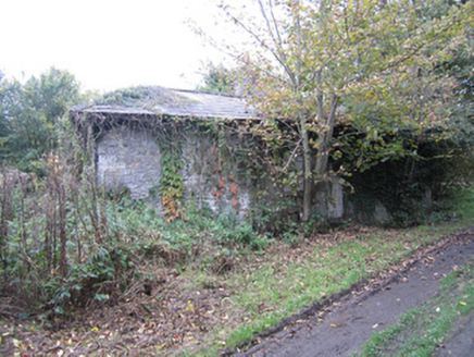
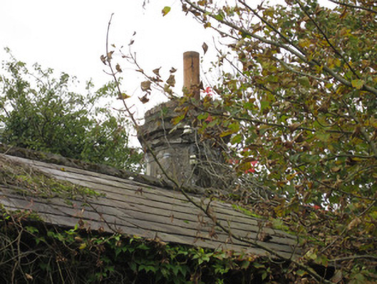
Description
Detached three-bay single-storey building, constructed c.1840, having canted porch to west, canal-front, elevation. Pitched slate roof with black clay ridge tiles, smooth rendered decagonal brick chimneystack and remains of half-round cast-iron rainwater goods previously held on overhanging eaves, timber soffit of which is supported by carved timber brackets. Roughly squared rubble walling with punch-finished ashlar to canted entrance bay, other window surrounds and projecting base plinth. Visible openings square-headed. All windows, which have stone sills, and door openings, closed with concrete blocks. House partially concealed under heavy ivy overgrowth and trees growing beside but was occupied until at least mid-twentieth century. Fronts onto Ulster Canal short distance south of Seventeenth Lock on roughly surfaced lane.
Appraisal
This is a distinctive structure related to the Ulster Canal which was built to plans by Directors General of Inland Navigation engineer, John Killaly. Its unusual decagonal chimney, and the quality of stonework to the canted porch show that this house, although derelict, is an architecturally elegant and well executed example of the structures associated with the now disused canal scheme.