
Survey Data
Reg No
31212031
Rating
Regional
Categories of Special Interest
Architectural, Scientific, Technical
Original Use
Bridge
In Use As
Bridge
Date
1800 - 1838
Coordinates
99982, 284389
Date Recorded
30/07/2008
Date Updated
--/--/--
Description
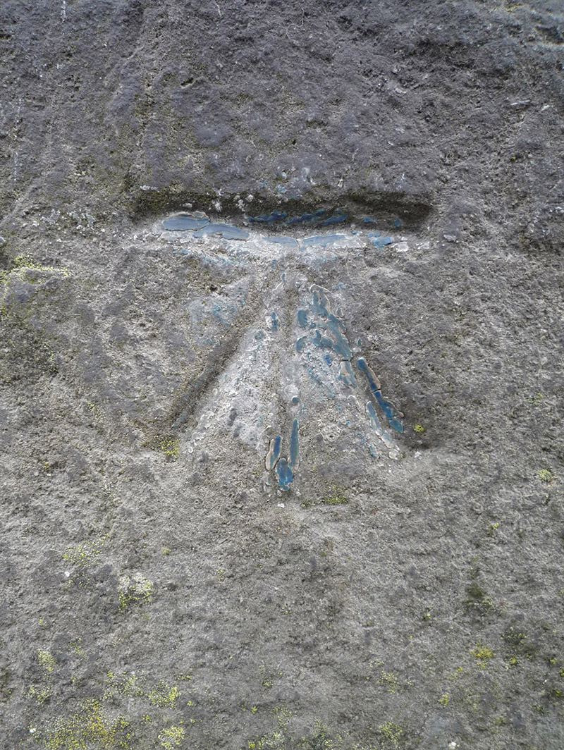
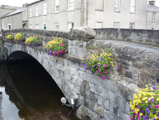
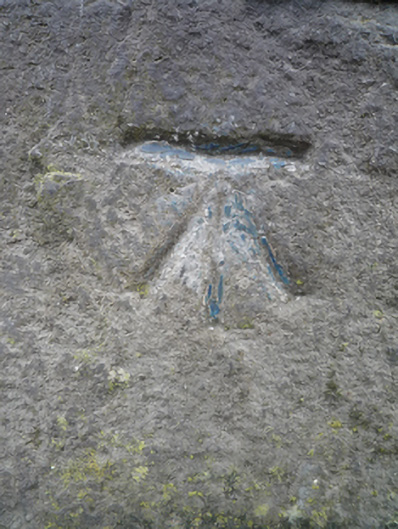
Single-arch hump back road bridge over river, extant 1838[?]. Tuck pointed rock faced limestone ashlar walls with dragged cut-limestone chamfered stringcourses supporting benchmark-inscribed parapets having rock faced cut-limestone coping. Single segmental arch with drag edged rock faced limestone ashlar voussoirs centred on drag edged rock faced cut-limestone keystones. Sited spanning canalised Westport or Carrowbeg River.
Appraisal
A bridge representing an important component of the civil engineering heritage of Westport with the architectural value of the composition confirmed not only by the rock faced surface finish demonstrating good quality workmanship, but also by the elegant "sweep" of the arch making a pleasing visual statement at a crossing over the canalised Westport or Carrowbeg River: meanwhile, a benchmark remains of additional interest for the connections with cartography and the preparation of maps by the Ordnance Survey (established 1824).