
Survey Data
Reg No
31209033
Rating
Regional
Categories of Special Interest
Architectural, Scientific, Technical
Original Use
Bridge
In Use As
Bridge
Date
1800 - 1838
Coordinates
114691, 290571
Date Recorded
26/11/2008
Date Updated
--/--/--
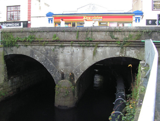
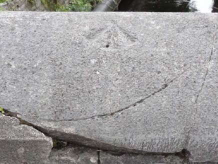
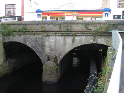
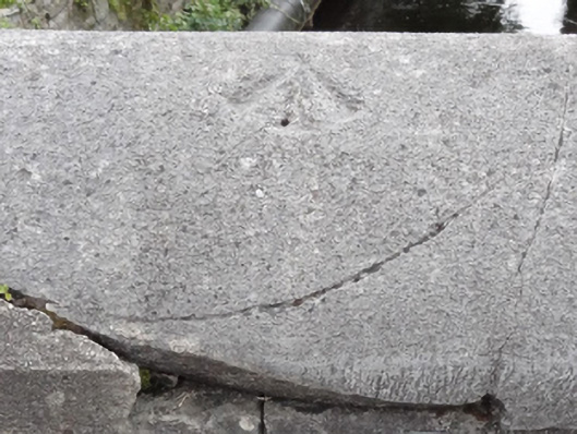
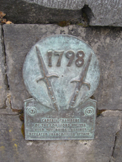
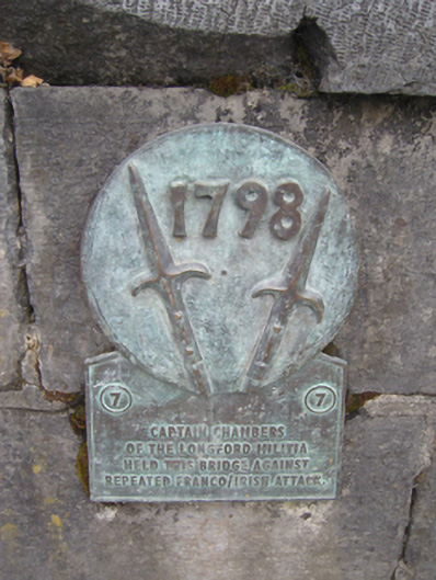
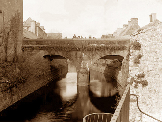
Description
Two-arch road bridge over river, extant 1838[?]. Part repointed tuck pointed limestone ashlar centred on drag edged tooled limestone ashlar battered rounded cutwater to pier having domed capping with dragged cut-limestone stringcourse supporting parapet having benchmark-inscribed drag edged tooled cut-limestone rounded coping. Pair of segmental arches with lichen-covered drag edged rusticated limestone ashlar voussoirs centred on drag edged tooled cut-limestone "bas-relief" keystones. Sited spanning canalised Castlebar River.
Appraisal
A bridge representing an integral component of the civil engineering heritage of Castlebar with the architectural value of the composition confirmed not only by the "sparrow pecked" sheer limestone dressings demonstrating good quality workmanship, but also by the elegant "sweep" of the arches making a pleasing visual statement at a crossing over the canalised Castlebar River: meanwhile, a benchmark remains of additional interest for the connections with cartography and the preparation of maps by the Ordnance Survey (established 1824).