


Survey Data
Reg No
13402406
Rating
Regional
Categories of Special Interest
Archaeological, Architectural, Artistic, Technical
Original Use
Bridge
In Use As
Bridge
Date
1700 - 1870
Coordinates
225881, 260285
Date Recorded
17/08/2005
Date Updated
--/--/--
Description
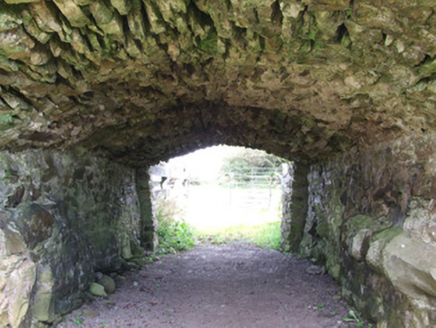
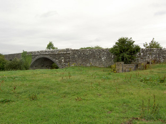
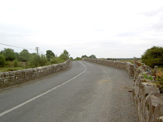
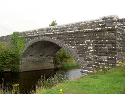
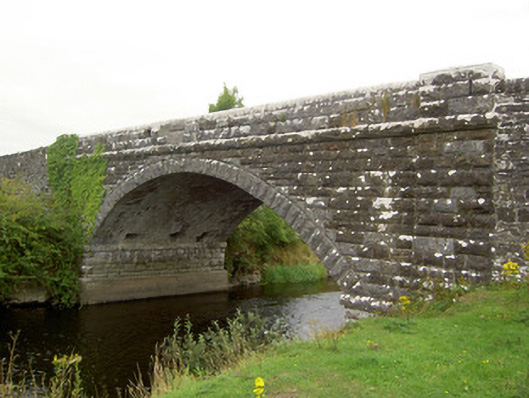
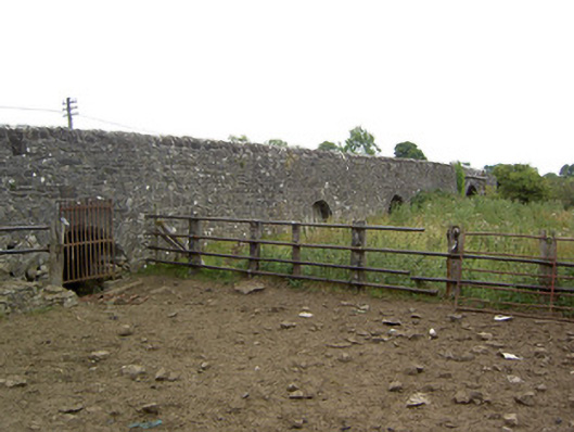
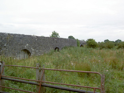
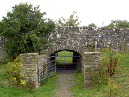
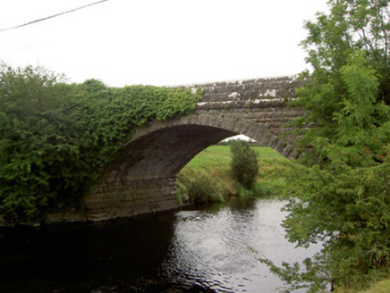
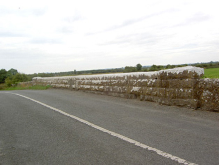
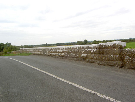
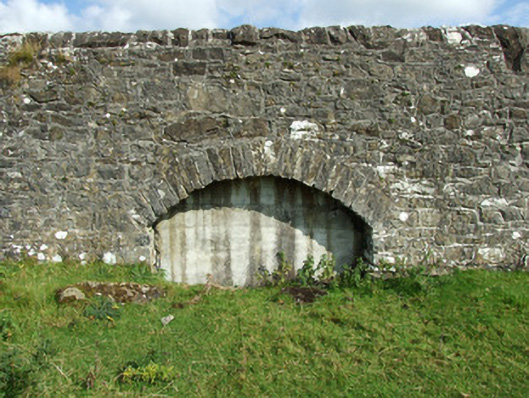
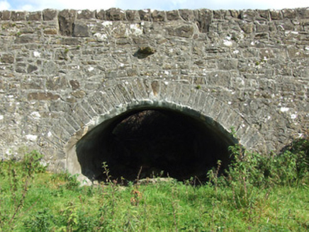
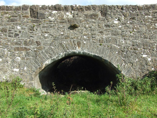
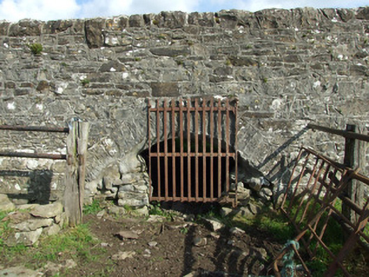
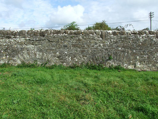
Road bridge over River Inny, built c. 1700 and altered c. 1860, comprising central single-arched section of River Inny, built c. 1860, with remnants of earlier multiple-arched bridge(s) to either side (northwest and southeast). Segmental-headed arch to central section having rock-faced limestone voussoirs with dressed margins. Squared coursed rock-faced limestone spandrel walls, parapets and abutments with rock-faced limestone string course at road deck level and rock-faced limestone string courses to impost level of arch/abutments. Squared dressed limestone masonry to barrel. Rounded cut limestone coping over parapets. Terminating coursed rock-faced piers (on square-plan) to either end of central arch having dressed limestone capstones over to ends of parapets. Ramped approaches to central arch either side (southeast and northwest) having redundant segmental-headed arches, three to southeast (County Westmeath side) and five to northwest (County Longford side). Rubble limestone construction to earlier parts of bridge having roughly squared rubble stone voussoirs to arches. Some arches now blocked. Rubble stone coping to parapets and wing walls. Spans border with County Westmeath, and located to the southeast of Legan.
Appraisal
This interesting and quite imposing bridge contains spans a long-standing crossing point of the River Inny, and contains the fabric of at least two distinct stages of construction. The impressive central arch dates to the mid-nineteenth century. The good quality heavily rock-faced masonry used in the construction of this arch, and the terminating piers to either side, are typical feature of the many bridges built throughout Ireland by the Board of Works in the mid nineteenth-century, and particularly between c. 1847 - 60, suggesting that they may have been responsible for its construction. The span of this central arch is among the largest in County Longford and is of some technical and engineering merit. The present bridge replaced and incorporates the fabric of an earlier and much wider bridge located at this site, which was built at a time when the River Inny was considerably wider at this point (Ordnance Survey first edition six-inch map 1838). The channel of the River Inny was dredged as part of drainage works (probably during the mid-nineteenth century, and at the same time the central section was rebuilt). The long rubble stone approach ramps to either side are a feature that this bridge shares with the bridge at Abbeyshrule (13402347) to the southwest. The small arches with radially-set rubble stone voussoirs with very wide piers between the arches suggest that this bridge is of considerable antiquity, perhaps dating to the late-seventeenth century. The bridge here was described Nicholas Dowdall, writing in 1682, as a stone bridge at 'Balnacarrow so called from a fishing near the River' (Gillespie and Moran 1991, 209). Sir Henry Piers, writing in 1684, also mentions the bridge at Agharra (Ballynacarrow). It is possible that the earlier sections of this bridge are part of the structure described by Dowdall. The simple forms of these arches are in contrast to the wide span of the later central arch, which provides an interesting historical insight into the development of bridge technology and engineering over a number of centuries. Ballynacarrow Bridge is an important element of the built heritage of Longford, and has provided an important river crossing for a considerable period of time.