


Survey Data
Reg No
13401704
Rating
Regional
Categories of Special Interest
Architectural, Artistic, Historical
Original Use
House
Historical Use
Hunting/fishing lodge
In Use As
House
Date
1810 - 1830
Coordinates
200174, 266530
Date Recorded
07/09/2005
Date Updated
--/--/--
Description
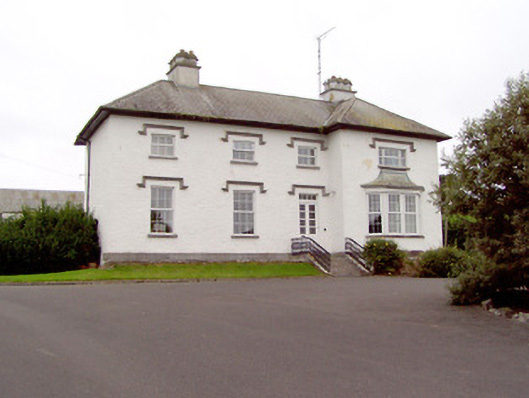
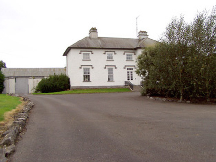
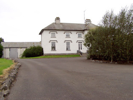
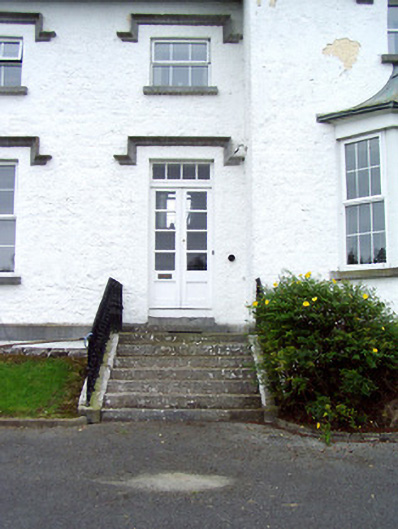
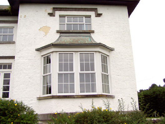
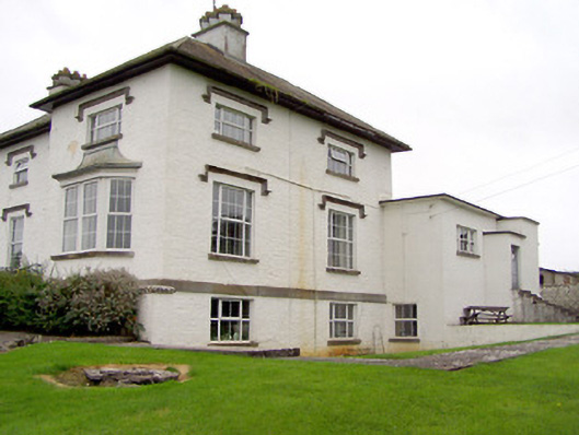
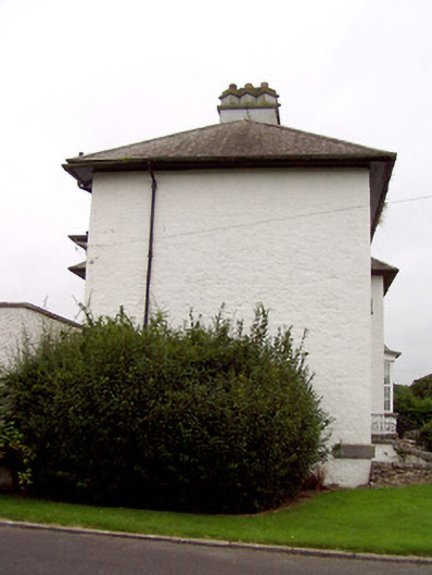
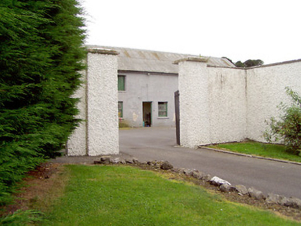
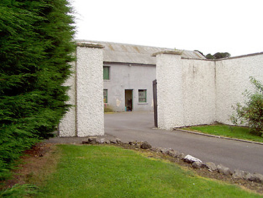
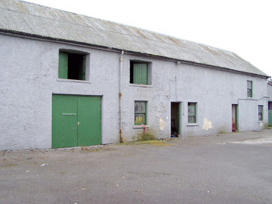
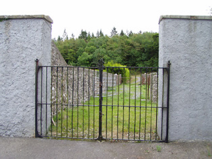
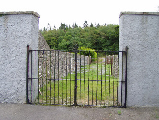
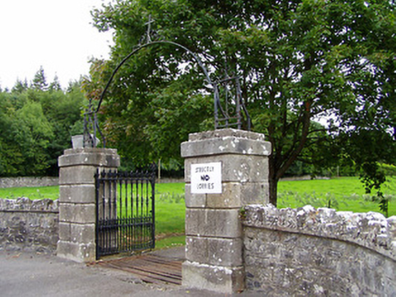
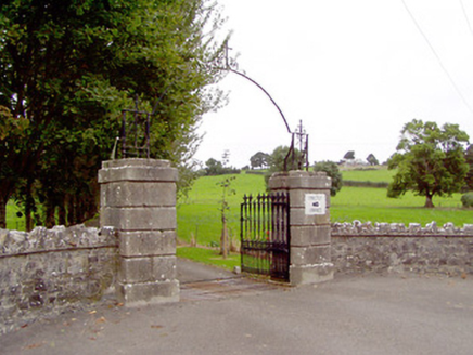
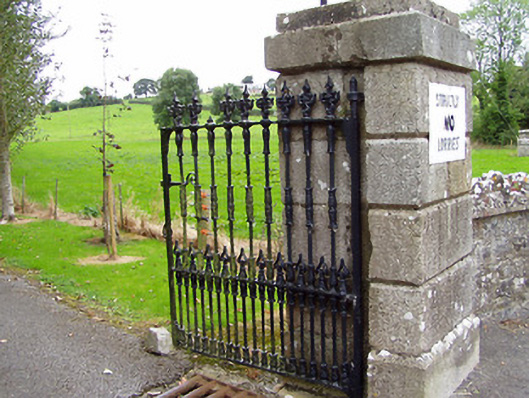
Detached four-bay two-storey over-basement house on T-shaped plan, built c. 1820, having projecting end bay to the west end of the front elevation (north), with canted single-storey bay window to front, and two-storey over basement return to the rear (south) at the west corner. Single-bay two-storey block to rear at re-entrant corner of return and single-storey over basement flat-roofed return (c. 1956) to south end of rear return. Possibly originally built as a hunting/fishing lodge. Later in use as a convent (Sisters of Mercy), c. 1956 to c. 1970, and now in use as a private house. Hipped natural slate roof with overhanging eaves and having two rendered chimneystacks with diagonal tops/chimney pots with cut stone coping. Sprocketed, hipped copper roof to canted bay window. Painted roughcast rendered walls with cut limestone string course between basement and ground floors. Square-headed window openings with replacement windows and having limestone label mouldings over and tooled limestone sills. Square-headed door opening adjacent to advanced end bay having glazed timber double doors with overlight. Flight of limestone steps to entrance flanked by cast-iron railings set on cut limestone plinth walls. Set back from road in extensive grounds to the south of Lanesborough, close to the northwest shores of Lough Ree. House located on an elevated site. Multiple-bay two–storey outbuilding to the rear having pitched corrugated-metal roof, cast-iron rainwater goods and projecting eaves course. Painted roughcast rendered walls. Square-headed window openings with painted limestone sills, some with two-over-two timber sliding sash windows. Square-headed door openings, some with timber battened doors and half-doors. Square-headed carriage arch to the east end of the main elevation (north) having timber battened double doors. Yard entered to the southeast of house through gateway comprising a pair of roughcast rendered gate piers (on square-plan) with cut stone caps and having wrought-iron gates. Gateway to east comprising a pair of painted roughcast rendered piers (on square-plan) having wrought-iron double gates. Main entrance gates to the north comprising a pair of rusticated (V-profile) ashlar limestone gate piers (on square-plan) having chamfered plinths and stepped capstones, and with decorative cast-iron gates. Round-headed wrought-iron arch over gateway, linking piers, having wrought-iron detailing and a wrought-iron cross finial to head. Rubble stone boundary walls on quadrant plan to either side of gateway (east and west), rubble stone boundary wall to road-frontage.
Appraisal
This substantial house retains much of its early form and character. The loss of the early fittings to the openings fails to detract substantially from its appearance. The plain front elevation is enlivened by the finely dressed cut stone detailing including the limestone label mouldings over the openings and by the wide string course above the basement level. The projecting end bay adds interest to the façade and breaks up the regularity of the elevation. The irregular-plan, the label mouldings over the openings, and the diagonally-set chimneystacks lend this building a muted Tudor Revival architectural character. The form of this building suggests that it dates to the late-nineteenth century. However, there is a building on this site on the same footprint and plan on an 1838 map of the area (Ordnance Survey first edition six-inch map). This suggests that the house may have been rebuilt or remodelled during the late-nineteenth century. The substantial, if plain, outbuilding to the rear retains much of its early character and fabric, and adds context to the main house. The main gateway to the north of the house is well-crafted in good quality ashlar stone work, and retains decorative cast-iron gates. It is notable for the unusual wrought-iron arch with cross finial over, which may be a later addition c. 1956, when the house was used as a residence by the Sisters of Mercy (see below). Set atop a steep incline, this house forms a striking silhouette in the landscape, and is an integral element of the built heritage of the local area. The rubble stone boundary walls, and the gates to site add to the setting and complete this composition, which is an integral element of the built heritage of the Lanesborough area. There is a house indicated at Rathcline, called Rathcloine, on a map of the area date 1777 - 83 (Taylor and Skinner). Rathcline House was in the ownership of Luke White in 1824 and in 1837 (Pigot’s Directory). The Whites were an important family and a number of members served as M. P.s, Lord Lieutenants and High Sheriffs of County Longford (and as M. Ps and Lord Lieutenants for County Dublin) during the first half of the nineteenth century. They were later granted the title Baron Annaly in 1863. The White family also owned Luttrellstown Castle, near Clonsilla (County Dublin), which Luke White bought from the Luttrell family c. 1800. This suggests that Rathcline House may have been built as a hunting lodge. It was later the home of a St. George Johnston (rented from White family), who rented 1,139 acres in Longford during the 1870s. It was described as both the home of St. George Johnston and as a vacant property in the ownership of Lord Annaly in 1894 (Slater’s Directory). Rathcline House was later used to accommodate Sister of Mercy nuns (1956 to c. 1970) who ran a school at nearby Lanesborough. The flat-roofed extension to the rear has a stained glass window of ecclesiastically character to one of the openings, perhaps indicating that it was built c. 1956 for use as a chapel by the nuns then resident there.