
Survey Data
Reg No
11805027
Rating
Regional
Categories of Special Interest
Architectural, Artistic, Scientific
Previous Name
The Parsonage originally The Lodge
Original Use
Gates/railings/walls
In Use As
Gates/railings/walls
Date
1840 - 1872
Coordinates
297197, 232894
Date Recorded
16/05/2002
Date Updated
--/--/--
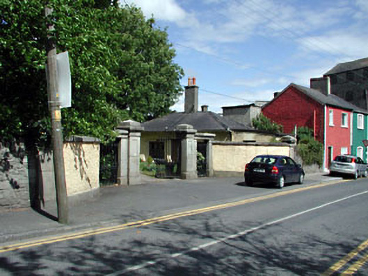
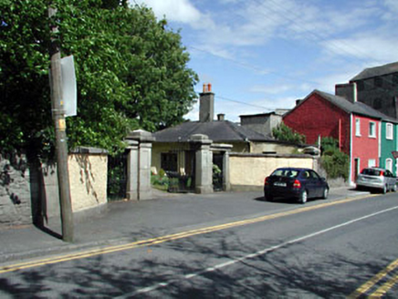
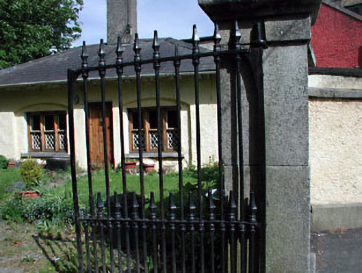
Description
Gateway, extant 1872, on a symmetrical plan comprising pair of granite ashlar panelled piers on cut-granite plinths having stringcourses below lichen-spotted shallow pyramidal capping supporting spear head-detailed cast-iron double gates with granite ashlar panelled outer piers on benchmark-inscribed cut-granite plinths having stringcourses below shallow pyramidal capping. Street fronted at entrance to grounds of Celbridge Lodge.
Appraisal
A gateway forming part of a self-contained group alongside an adjacent gate lodge (see 11805026) with the resulting ensemble making a pleasing visual statement in Church Road: meanwhile, a benchmark remains of additional interest for the connections with cartography and the preparation of maps by the Ordnance Survey (established 1824).