


Survey Data
Reg No
50100297
Rating
Regional
Categories of Special Interest
Architectural, Artistic
Original Use
House
In Use As
Office
Date
1770 - 1790
Coordinates
316286, 233358
Date Recorded
26/07/2016
Date Updated
--/--/--
Description
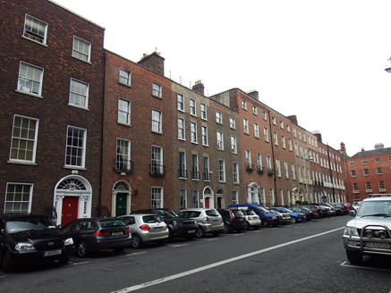
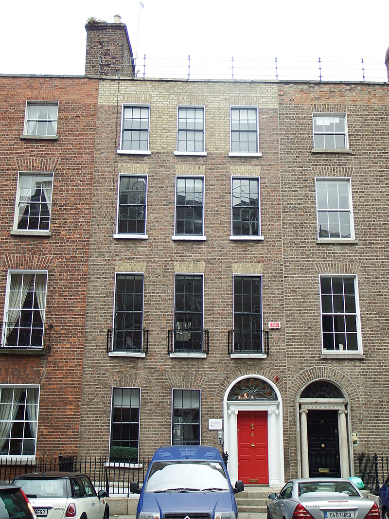
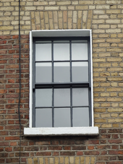
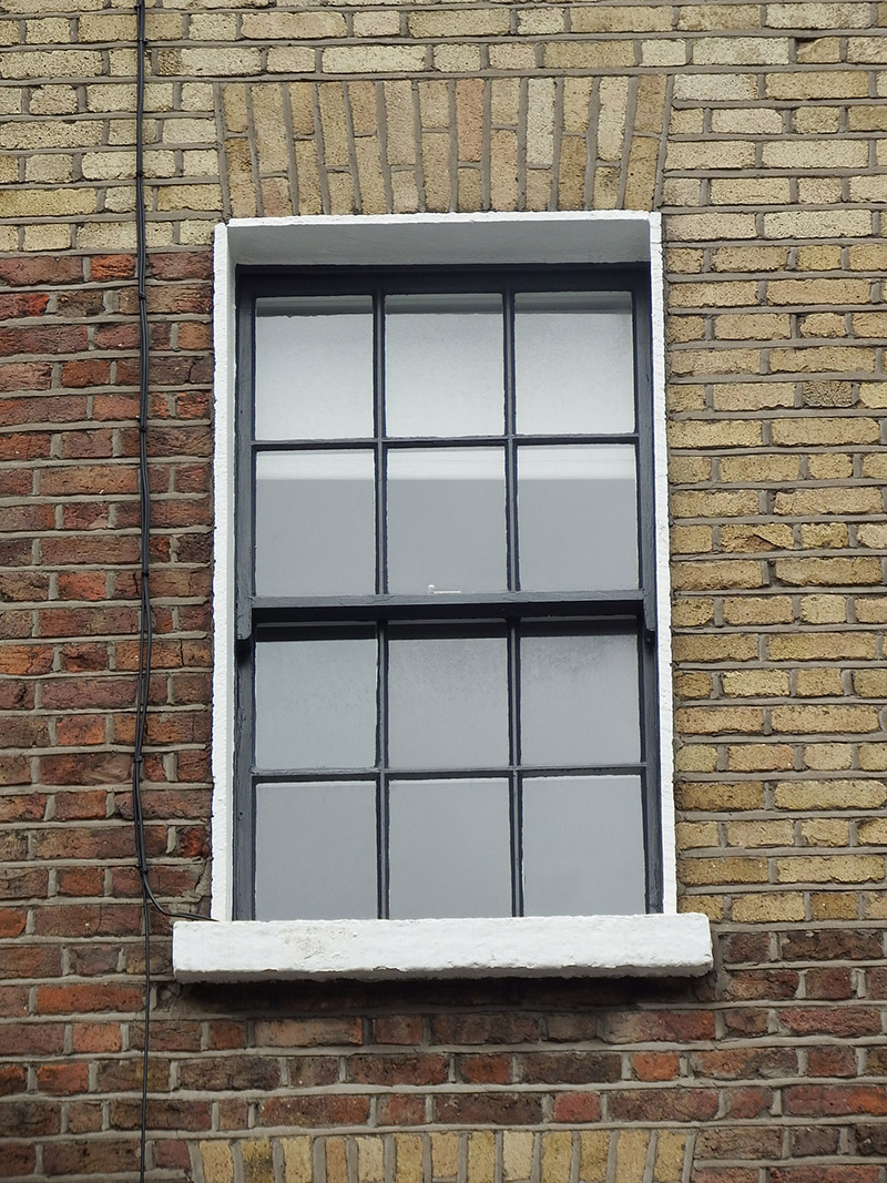
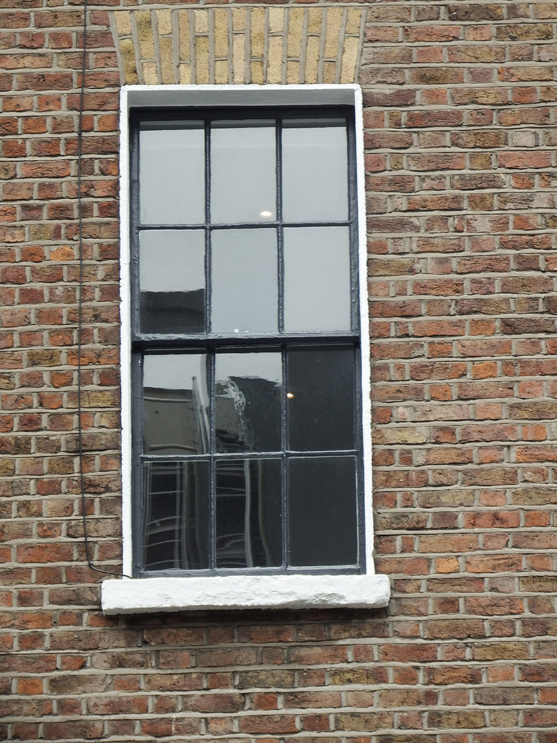
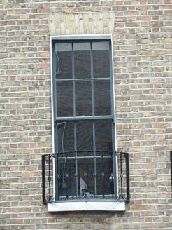
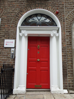
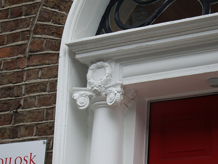
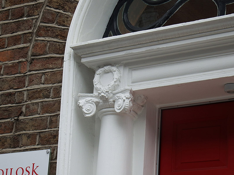
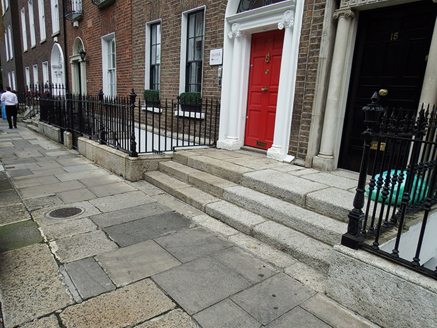
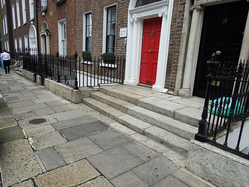
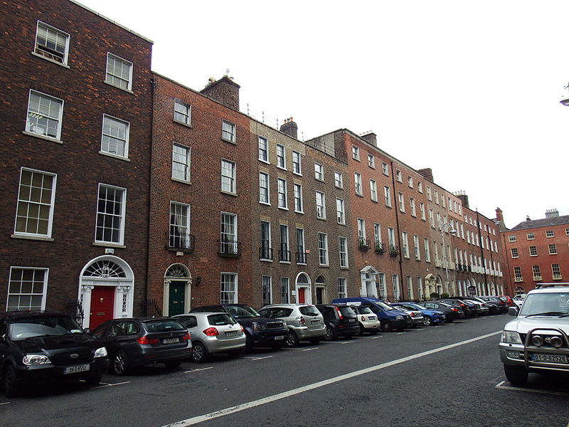
Attached three-bay four-storey former house over basement, built c. 1780. Now in use as offices. Flat roof behind rebuilt brick parapet with granite coping, having decorative cast-iron handrail, and concealed rainwater goods. Large brown brick chimneystack to west party wall with yellow clay pots. Flemish bond buff brick walling over granite plinth course, with painted rendered walling to basement; rendered to rear. Square-headed window openings, diminishing in height to upper floors, with rebuilt brick voussoirs, painted masonry sills and patent reveals. Largely replacement six-over six pane timber sliding sash windows with ogee horns, early sashes to second floor without horns and having some historic glass, convex horns to top floor, and tripartite windows to basement with iron grilles; apparently timber sash windows to rear, including round-headed stairs windows to east bay, and some windows having metal window-guards. Decorative cast-iron balconettes to first floor. Round-headed door opening with painted masonry doorcase having moulded reveals, entablature with panelled frieze and laurel leaves over freestanding Ionic columns, cast-iron peacock-tailed fanlight and replacement eight-panel timber door with recent brass furniture. Shared granite entrance platform with three steps to street. Basement area enclosed by spear-headed cast-iron railings with decorative corner posts over granite plinth. Recent door to basement area, accessed by concrete steps. Yard to rear.
Appraisal
A modest late eighteenth-century Georgian house that is set apart from much of the street by the narrow three-bay façade. The relatively plain frontage is enriched by a good neo-Classical doorcase and ironwork setting features. In conjunction with Ely Place, Hume Street forms a T-plan arrangement of residential streets, laid out in 1768 by the surgeon and property developer Gustavus Hume. Variations in scale, detailing and parapet height across this northern section of the street are indicative of the speculative and piecemeal nature of its construction. Despite some replacement fabric insertions, the overall character of No. 16 is largely retained, contributing to the significant eighteenth-century character of Hume Street, the streetscape being largely well preserved on this northern section, and to the wider architectural heritage of south Dublin.