


Survey Data
Reg No
50080133
Previous Name
Saint Michael's Terrace
Original Use
House
In Use As
House
Date
1890 - 1910
Coordinates
312993, 233428
Date Recorded
08/05/2013
Date Updated
--/--/--
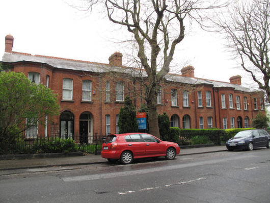
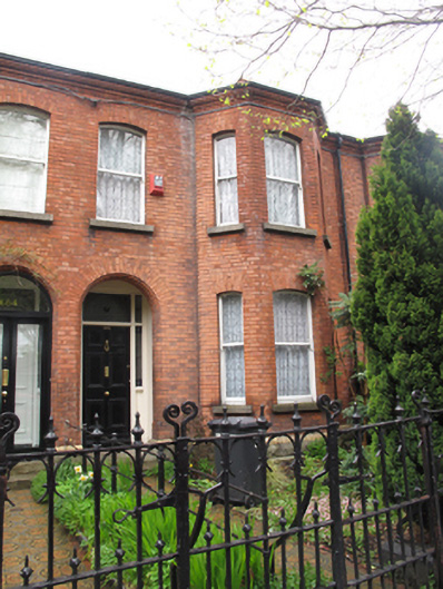
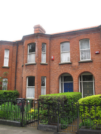
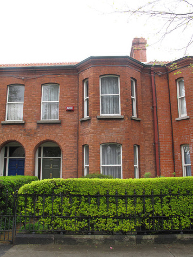
Description
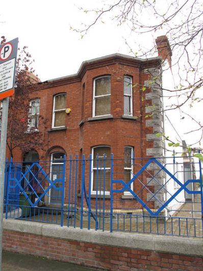
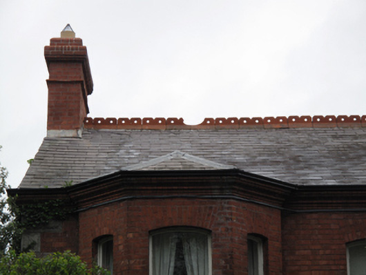
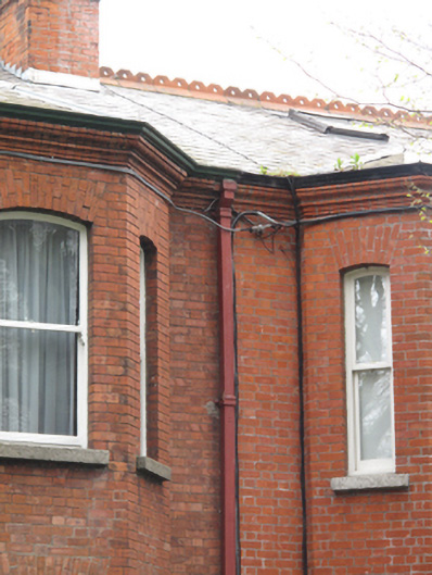
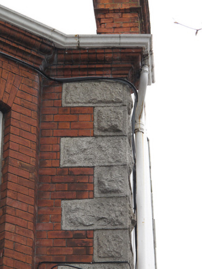
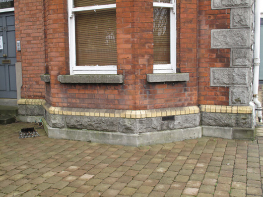
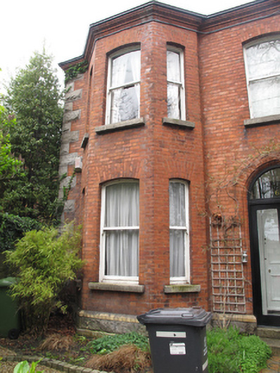
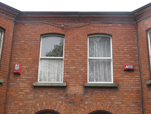
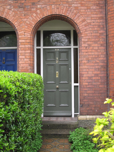
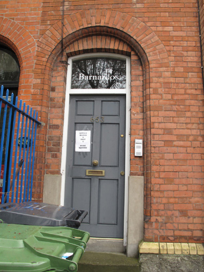
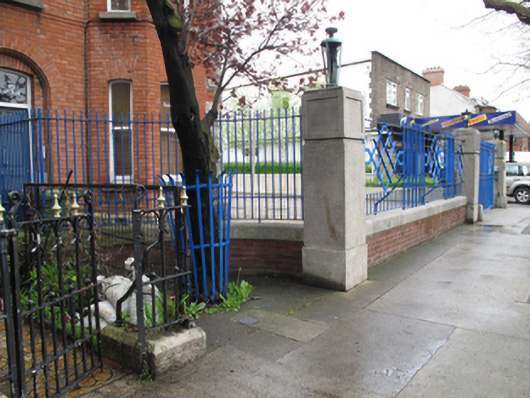
Terrace of six two-bay two-storey houses, built c.1900, having paired returns to rear (north) elevation and each having full-height canted bay window to front (south) elevation. Pitched slate roof with terracotta ridge cresting, red brick chimneystacks, hipped slate roofs to bay windows, cast-iron rainwater goods and moulded brick eaves course. Red brick, laid in Flemish bond, to front (south) elevation, rusticated granite quoins, rusticated granite plinth course having moulded yellow brick coping, rendered walls to east and rear elevations. Segmental-headed window openings having red brick voussoirs, granite sills and one-over-one pane timber sash windows. Replacement uPVC windows to no.656. Round-headed door openings to front, bull-nosed red brick voussoirs, carved brick surrounds, to recessed porches with timber panelled doors with sidelights and overlights, tiled floors and granite steps, some tiled pathways to footpath. Some recent glazed doors to front of porches. Segmental-arched door opening set within arch to No.653. Cast-iron railings separating gardens to front of houses, front boundary having cast-iron railings on painted masonry plinth wall, matching cast-iron pedestrian gates. Recent steel railings on red brick wall having square-profile granite corner columns to No.653.
Appraisal
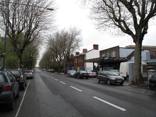
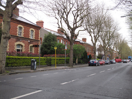
This fine terrace is representative of architectural design and construction at the turn of the century. Sharing a fenestration alignment and parapet, a strong sense of uniformity is evident in these houses, and they make a positive contribution to the streetscape. The full-height canted bay windows provides a pleasing sense of symmetry to the façade. The encircling of the city was achieved with the completion of North and South Circular Roads at the close of the nineteenth century and this terrace adheres to a building tradition which is typical of suburban house design at that time. This stretch of the road was referred to as 'building ground' up until 1897 in Thom's Directory, and the terrace was marked 'St. Michael's Terrace' on the Ordnance Survey map of 1907.