


Survey Data
Reg No
50070284
Rating
Regional
Categories of Special Interest
Architectural, Social
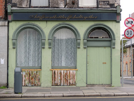
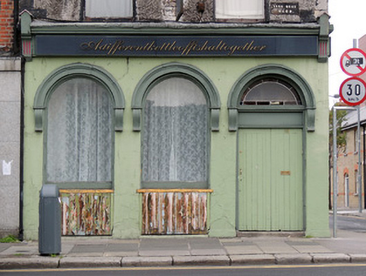
Previous Name
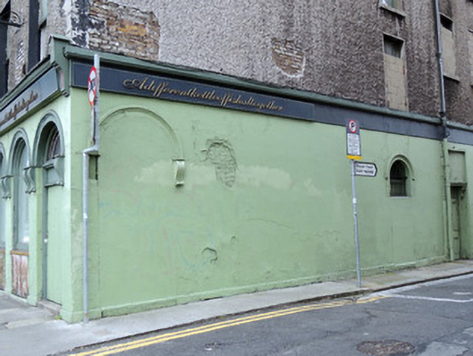
Adifferentkettleoffishalltogether
Original Use
House
Historical Use
Public house
In Use As
Apartment/flat (converted)
Date
1700 - 1740
Coordinates
315266, 234225
Date Recorded
20/09/2012
Date Updated
--/--/--
Description
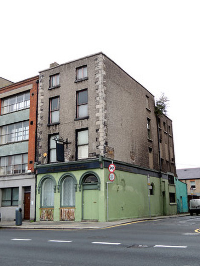
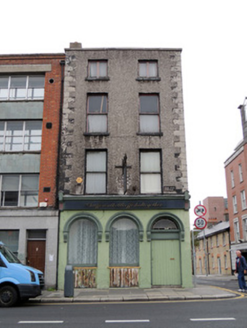
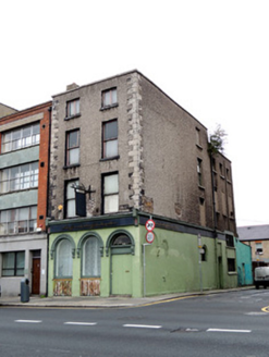
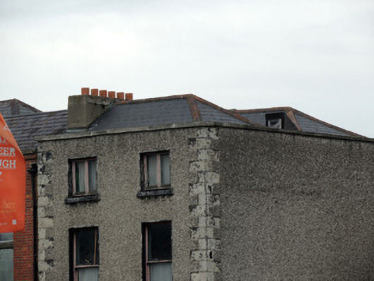
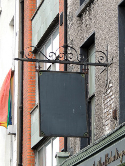
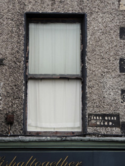
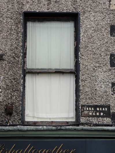
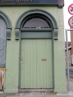
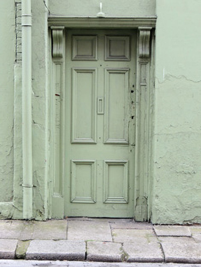
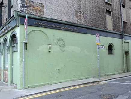
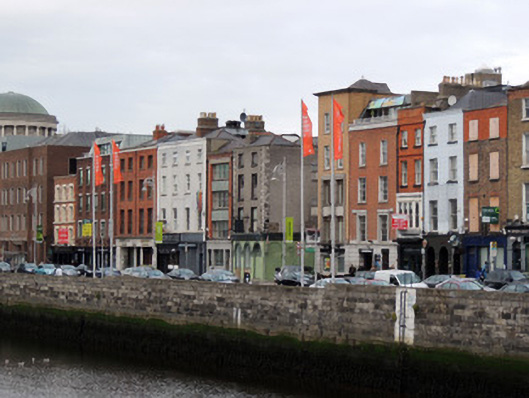
End-of-terrace two-bay four-storey former house, built c.1720, with lower three-bay return to rear, and later shopfront to front elevation. Formerly also in use as public house. Now in use as flats. M-profile hipped artificial slate roof with terracotta ridge tiles. Cement rendered chimneystack with replacement terracotta chimneypots. Roughcast rendered walls, brick exposed in places, with cut stone quoins and cement rendered coping to parapet. Wrought-iron hanging sign and cast-iron plaque to first floor of front (south) elevation 'INNS QUAY/WARD.' Square-headed window openings, with timber casement windows to third storey, one-over-one pane timber sash windows to first and second floors, each with rendered reveals and painted stone sills. Shopfront to front elevation, having recent nameplate and round-headed openings having carved stone surrounds and consoles. Plate glass windows with timber frames and sills over timber battened risers, and double-leaf timber battened doors with leaded fanlight. Painted rendered walls to shopfront, and to ground floor of east elevation. Infilled round-headed opening near corner on east elevation. Square-headed door opening to east elevation having timber panelled door with carved timber surround. Concrete paving to south elevation with some granite paving to east elevation, granite kerbstones to south and east.
Appraisal
No.18 Ormond Quay Upper forms part of a terrace of buildings facing south to the River Liffey. The former townhouse retains its elegant eighteenth-century proportions, and its historic character is enhanced by the presence of granite kerbstones to the south and east, and the wall plaque naming Inns Quay Ward. Ormond Quay owes its development to the pioneering construction works by Sir Humphrey Jervis in the late seventeenth century, when he reclaimed the land west of Arran Street, c.1675, formerly the estuary of the River Bradogue or Pill. Rocque’s map of 1756 shows No.18 with perpendicular buildings to the north, facing east on to Arran Street. These buildings were subsumed into No.18 in the nineteenth century. No.18 traded as a green grocers and wine and spirit merchant for much of the nineteenth century and as a restaurant in the mid-twentieth century. The arcade to the ground floor adds interest to the streetscape, and is indicative of its commercial function. The blocked opening to the east elevation may have been a doorway creating an internal corner porch to attract customers into the premises from both streets.