


Survey Data
Reg No
50010882
Rating
Regional
Categories of Special Interest
Architectural, Artistic
Original Use
House
In Use As
Bank/financial institution
Date
1790 - 1800
Coordinates
315573, 235304
Date Recorded
23/09/2011
Date Updated
--/--/--
Description
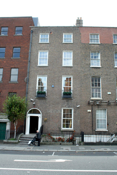
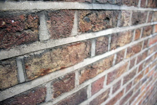
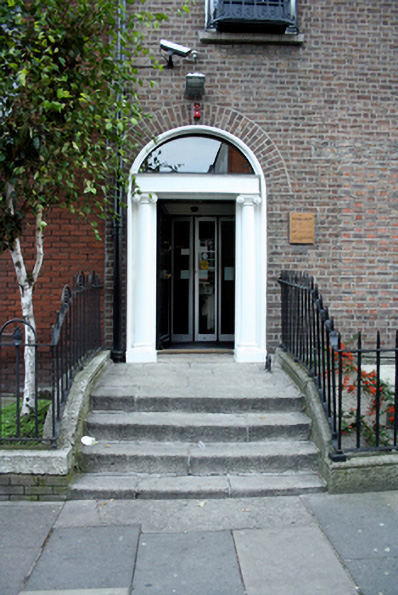
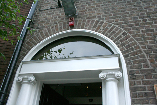
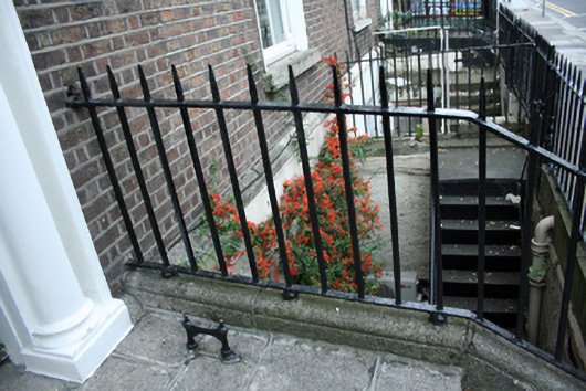
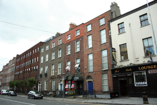
Terraced two bay four-storey house over exposed basement, built c.1795. Concealed M-profile pitched slate roof behind red brick parapet wall with squared granite coping. Yellow brick chimneystack with rendered base and moulded clay pots to northern boundary, shared with No. 22. Replacement uPVC rainwater goods and concealed gutters. Flemish bond yellow brick walls with roughcast rendered basement beneath moulded granite plinth course. Recent re-pointing evident to ground level. Diminishing square-headed window openings with gauged red brick voussoirs, patent rendered reveals, granite sills and replacement uPVC windows throughout. Replacement decorative metal balconettes to first floor windows. Round-headed door opening with moulded rendered reveals and stone doorcase comprising engaged Ionic columns supporting replacement entablature and plain fanlight. Timber panelled door with brass door furniture and timber weatherboard. Square headed door opening to basement with recent steel door. Granite stepped approach with four granite steps bridging basement area having cast-iron bootscraper to right of door. Spear-headed wrought-iron railings on moulded granite plinth enclosing basement area. Replacement metal railings enclose entrance platform to south. Cast-iron newel post and replacement gate allow access from street to metal steps leading to basement.
Appraisal
No. 23 appears to have been built as a pair with No. 22. The yellow brickwork of this pair sets them apart from the predominantly red brick houses located elsewhere on the street, though the adjacent houses Nos. 20 and 21 are of similar scale and materials. Judging from the exterior, the property is in reasonably good condition, although no original windows survive on the front façade. The fine doorcase has been retained, as has the flight of stone entrance steps and plinth and the iron railings to the basement area. The barley fields north of Cavendish Row were surveyed by Thomas Sherrard in 1789 and in 1790 a plan of Frederick Street North was laid before the Wide Street Commissioners. It was approved by the Wide Streets Commission and its development is documented in the Wide Streets Commission's minutes of the time. The street opened in 1795, with development continuing into the early decades of the nineteenth century. It formed a connecting route from Rutland Square (now Parnell Square), through the 'Barley field' depicted on Wilson's Directory maps, to the north.