


Survey Data
Reg No
50010411
Rating
Regional
Categories of Special Interest
Architectural, Artistic, Social
Previous Name
Keating's
Original Use
House
In Use As
Public house
Date
1740 - 1760
Coordinates
315524, 234408
Date Recorded
07/12/2011
Date Updated
--/--/--
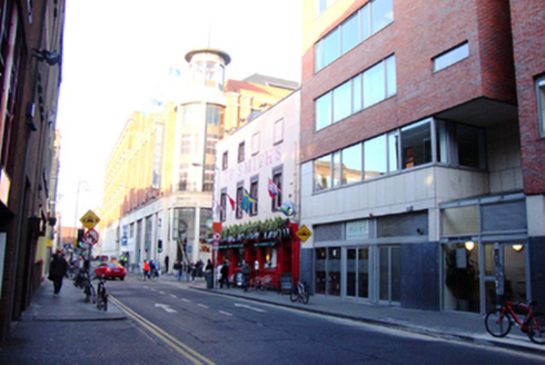
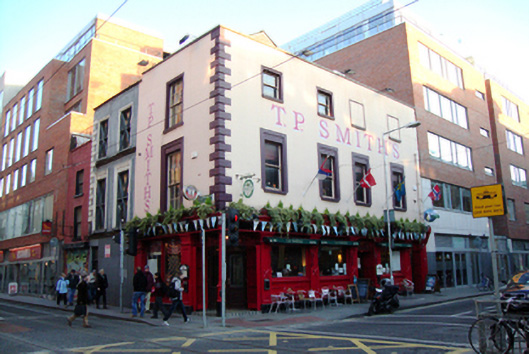
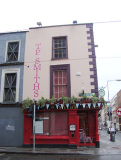
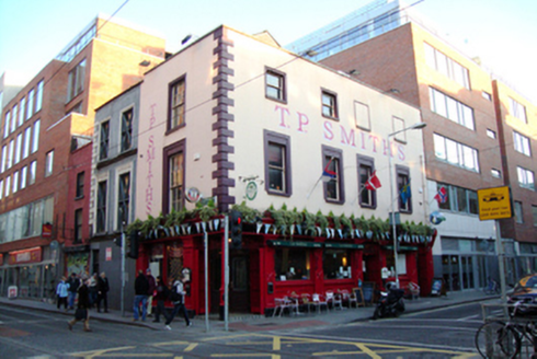
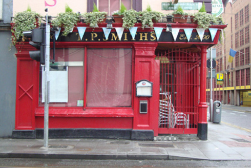
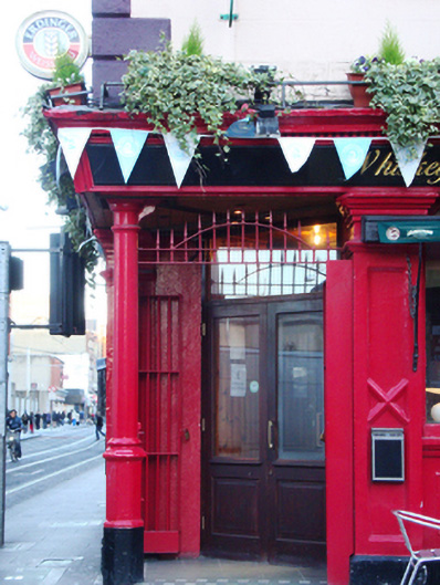
Description
Attached corner-sited three-storey house over concealed basement, built on corner of Jervis Street and Abbey Street Upper c.1750, now in use as public house. Double-pile pitched roof, gabled to Jervis Street, hidden behind parapet wall. Cement rendered chimneystack on party wall with no. 19 Abbey Street Upper to east. Cast-iron hopper and rainwater goods breaking through parapet at junction with no. 10 to north. Ruled-and-lined rendered walls to west and north elevations, having quoins at corner of Jervis Street and Abbey Street Upper, and granite coping to parapet. Painted lettering 'T.P. Smiths' horizontally above first floor west elevation and vertically on north elevation. Timber shopfront to ground floor having 'T.P. Smith's Est. 2000' to timber nameplates. Low granite plinth and timber Doric style engaged pilasters having rectangular panels with central cross decoration. Plain entablatures supporting timber fascia with dentillated cornice. Timber stall risers with decorative central round panels flanked by shaped panels. Square-headed windows openings to first and second floors having rendered and painted moulded window surrounds, rendered painted reveals and painted granite sills. Single-pane timber sliding sash windows having convex horns to west elevation and blind windows to two second floor bays to south of west elevation. Original six-over-six pane timber sliding sash windows to first and second floors of north elevation. Square-headed window openings to shopfront having fixed pane display windows, paired and divided by central mullion to north. Cast-iron column on tall octagonal base and octagonal painted granite plinth at corner of Jervis Street and Abbey Street Upper, supporting building over canted entrance, tiled granite entrance platform approaching square-headed door opening with double-leaf glazed door surmounted by rectangular overlight. Secondary square-headed entrances to west elevation on Jervis Street having two double-leaf glazed doors with overlights. Metal doors to pavement of Jervis Street giving access to concealed basement. Concrete poured path to Jervis Street with granite kerbing, concrete paved path to Abbey Street Upper with concrete kerbing.
Appraisal
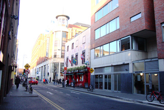
This public house incorporated two eighteenth-century houses, Nos.9 and 10 Jervis Street, which were used as tenements (No.9) and a grocer’s (No.10) in 1850. By 1870 Nos.9 and 10 were both occupied by Nicholas Behan grocer and spirit dealer, so it can be assumed the joined premises took on the function of a public house at this time. The proportions and window arrangement are a valuable reminder of the former residential function of these buildings and are a very rare survival of the eighteenth-century fabric of Jervis Street. The three-storey pub is now completely dwarfed by the Jervis Centre to the north, apartment complexes to the east and south, and a multi-storey car park to the west. Jervis Street was named after Humphrey Jervis, Lord Mayor of Dublin in 1681-3, who laid out the area around Saint Mary’s Abbey after buying much of this estate in 1674. Jervis developed a network of streets arranged in a nine-square grid, including Jervis Street, Stafford Street (now Wolfe Tone Street), and Capel Street, as well as building Essex Bridge. Jervis Street was once occupied by late seventeenth-century and early eighteenth-century gabled houses and Rocque’s map of 1756 shows terraced houses at the junction of Swift's Row and Jervis Street. The Jervis Street Hospital was founded north of Nos.9 and 10 in 1718, a plain brick hospital building was erected in 1803 was replaced in 1885 by a nine-bay four-storey building by Charles Geoghegan of red brick over a limestone base.