


Survey Data
Reg No
40901826
Rating
Regional
Categories of Special Interest
Architectural, Historical, Technical
Previous Name
Fort Dunree
Original Use
Battery
In Use As
Museum/gallery
Date
1890 - 1910
Coordinates
228842, 439057
Date Recorded
29/11/2008
Date Updated
--/--/--
Description
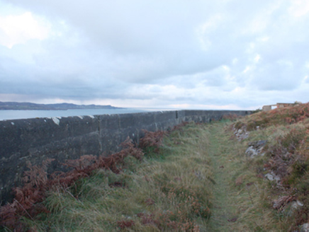
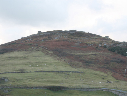
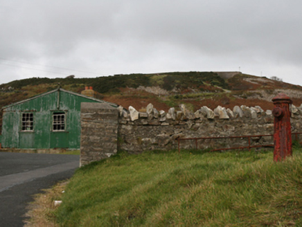
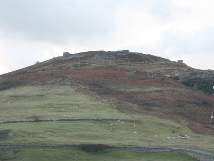
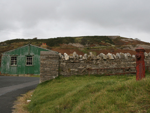
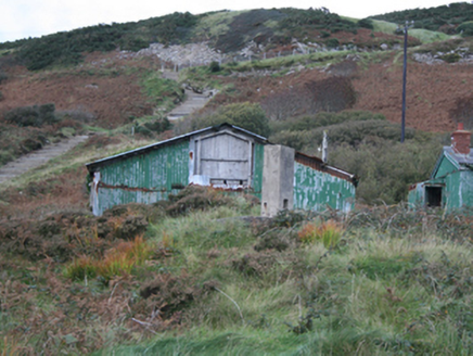
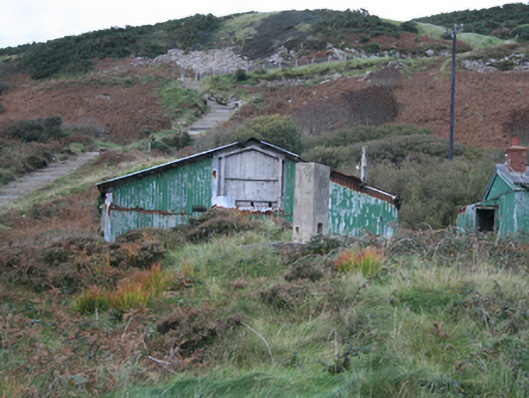
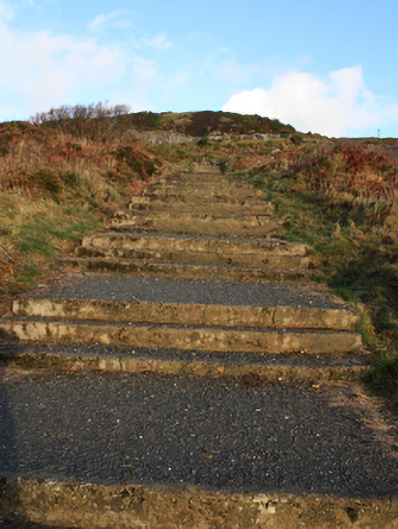
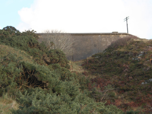
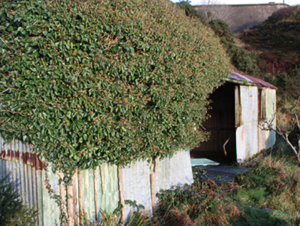
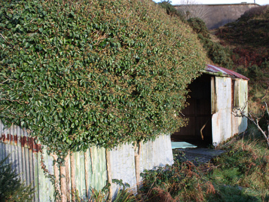
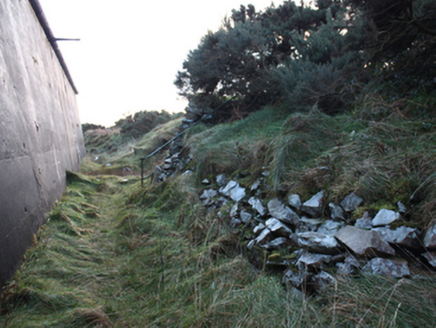
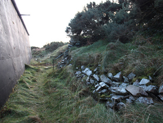
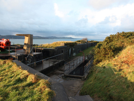
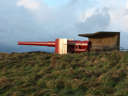
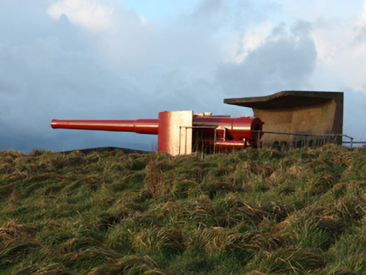
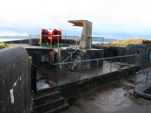
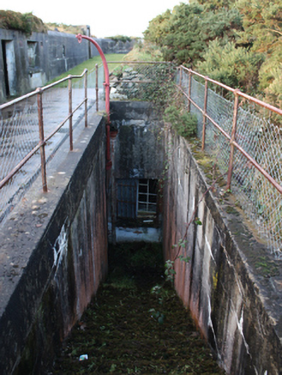
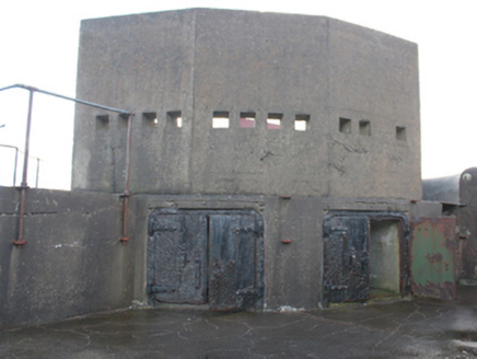
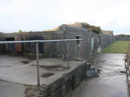
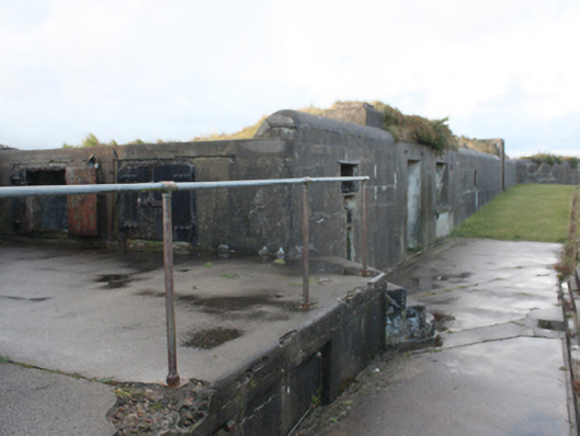
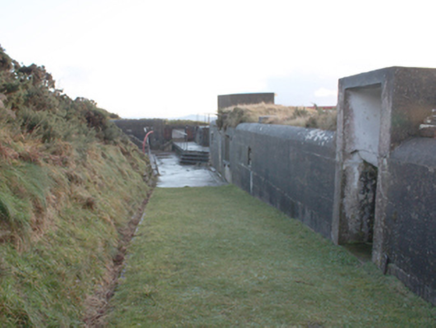
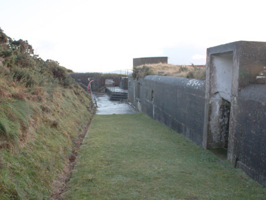
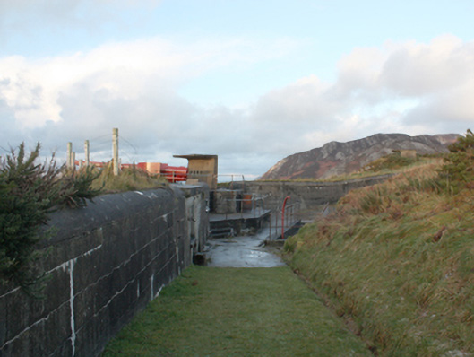
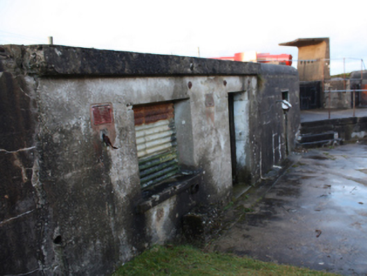
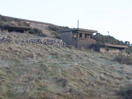
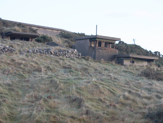
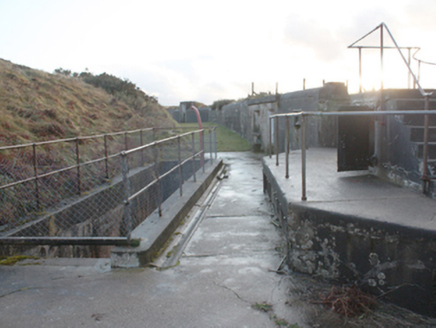
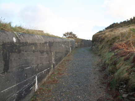
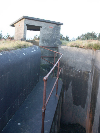
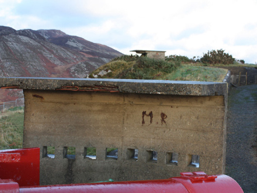
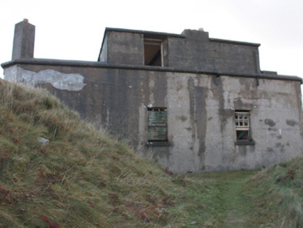
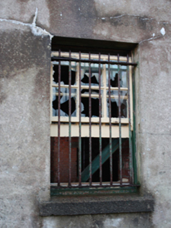
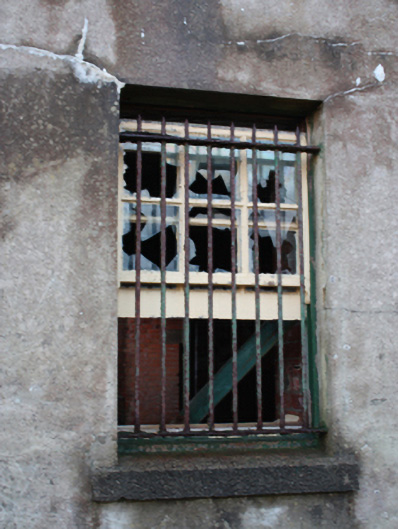
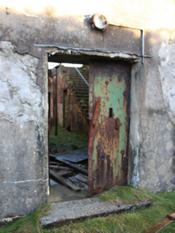
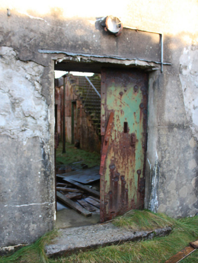
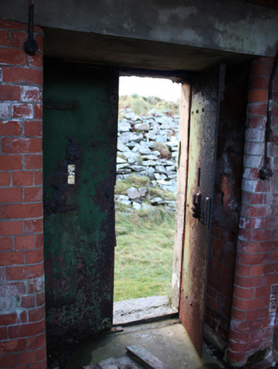
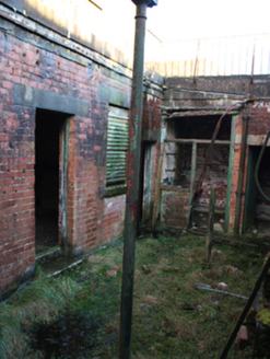
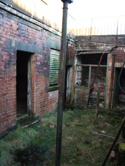
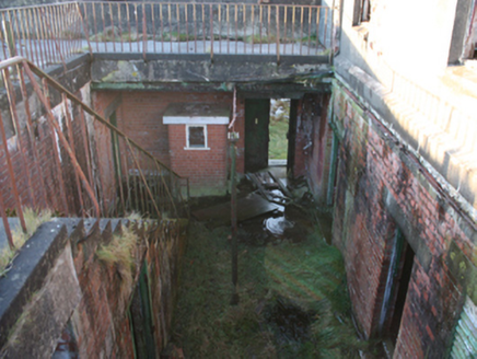
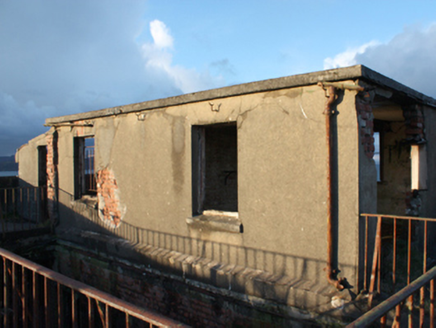
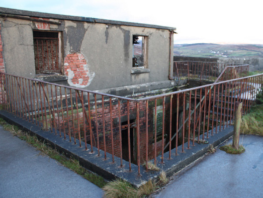
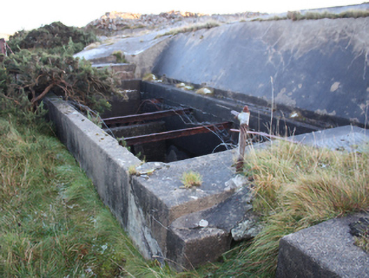
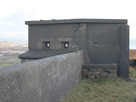
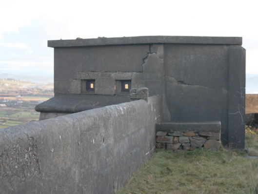
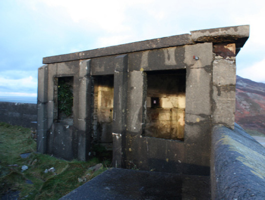
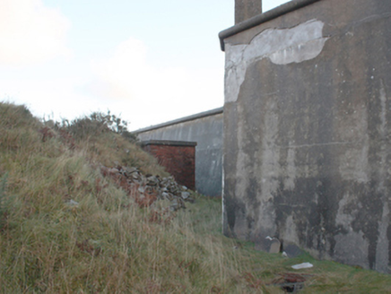
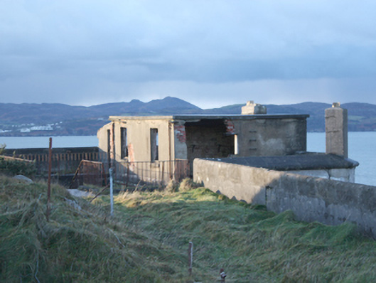
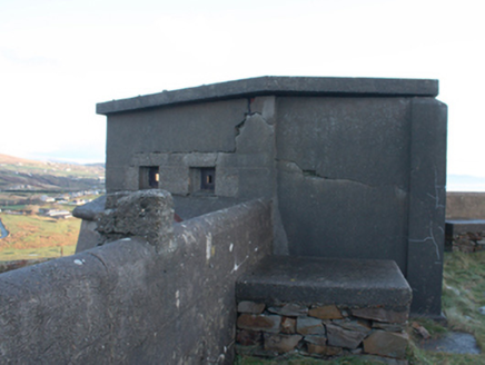
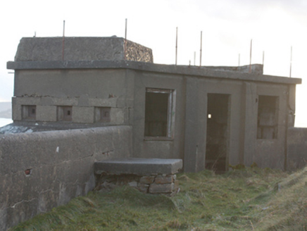
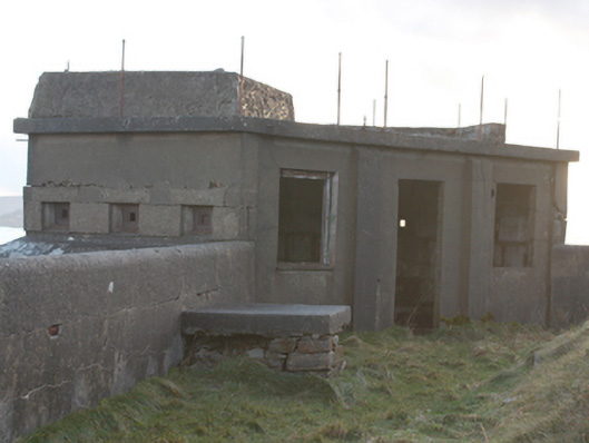
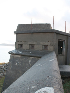
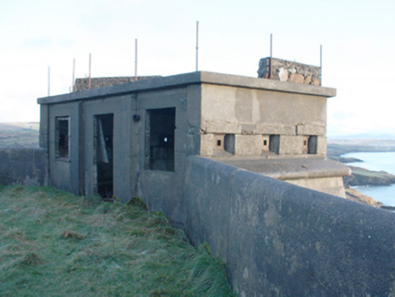
Military coastal battery and redoubt complex on polygonal seven sided-plan, built c. 1895-97, now out of use; part of military museum. Battered reinforced concrete curtain\scarp walls with external ditch surrounding summit of Dunree Hill. Metal railings to curtain wall in places. External section of boundary wall to the west and north of inner fort \redoubt having gun emplacements (on circular-plan) on raised concrete terrepleins. Vaulted subterranean chambers to site; including sunken magazines with pulley mechanisms adjacent to former gun emplacements. Chambers built into side of boundary walls to west and north of site having vaulted roofs covered in earth. Redoubt entered from north-west through two-storey blockhouse having brick walls to internal face at ground floor level and cement rendered brick walls, square-headed window and door openings to interior face at first floor level, square-headed window openings with remains of six-over-six pane timber sliding sash windows and with iron security bars to ground floor (external) and square-headed door opening with heavy metal double-doors; concrete stairways within giving access to redoubt having metal railings. Single-storey concrete lookout points\pillboxes (on canted-plan) to angles of curtain wall of redoubt having flat concrete roofs with remains of metal railings and parapet walls, reinforced concrete walls, square-headed window and door openings to interior face, and small square-headed gun embrasures and look-outs to external faces; sloping concrete coping to external faces beneath openings. Ruinous single-storey corrugated-metal clad buildings to north of site; ruinous single-storey building to site having flat concrete roof, cement rendered walls, and square-headed openings; now derelict. Single-storey store to site having flat concrete roof, red brick walls, and square-headed openings. Sunken water tanks to site. Pathways with intermittent flights of concrete steps approaches site from former barracks complexes (see 40901824) to the west of site. Located on Dunree Hill at Dunree Head peninsula to east bank of Lough Swilly. Earlier fort (see 40901813) to the west.
Appraisal
This impressively-sited coastal battery and redoubt survives in good condition despite a long period of disuse. It consists of two distinct structures: an enclosed inner redoubt with high cement walls with pillboxes at intervals along its length defending approaches from land; and a two-storey gatehouse to the north-west; and an outer section of wall with gun emplacements, sunken magazines and extramural chambers to the west and the north defending the views over Lough Swilly and approaches from the sea. This fort was built in 1895 – 97 by the British Authorities to defend Lough Swilly, an important anchorage for the Royal Navy, and a potential location for an attempted invasion. It largely superseded the earlier Napoleonic-era coastal battery (see 40901813) to the west, which was built in 1812 – 13, and which was also modified at the same time that this new fortification was constructed. The later fort originally had two 4.7-inch guns, with an additional 4.7-inch gun added to the earlier fort. These were replaced in 1906 by two 4.7-inch guns, and in 1912 by two mark VII 6-inch guns that constituted the main armament at the site until its closure in 1945. This fort was built around the same time that a similar fortification was constructed at Lenan Head (see 40900913) to the north, and these two forts constituted the main defence for Lough Swilly. As a Treaty Port, these fortifications remained in British hands until 1938, when they were handed over to the Irish Army. Fort Dunree was occupied by the Irish Army during World War Two\The Emergency, and anti aircraft guns were added at this time. This fortification forms part of a site that together constitute one of a number of coastal batteries built by the British military around Lough Swilly along with Inch Fort and Neid’s Point to the south, Lenan Head to the north, and Muckamish, Rathmullan and Knockalla to the far side of the Lough. Of historic importance to the Irish nation, shedding light on the strategic value of Lough Swilly especially to the British during World War One, and played an integral role in safeguarding Ireland’s neutrality during World War Two. Furthermore, the site provides insight into the defensive thinking of military planners and the skills of military engineers at the turn of the twentieth-century, and constitutes an important element of the built heritage of Donegal.