


Survey Data
Reg No
40843030
Rating
Regional
Categories of Special Interest
Historical, Social
Original Use
Milestone/milepost
In Use As
Milestone/milepost
Date
1750 - 1810
Coordinates
193141, 378456
Date Recorded
09/11/2007
Date Updated
--/--/--
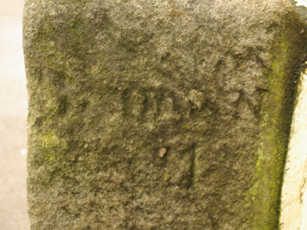
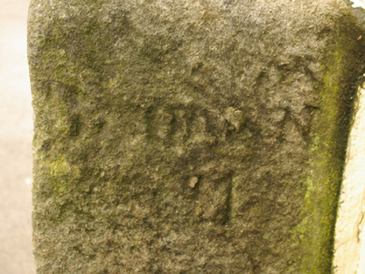
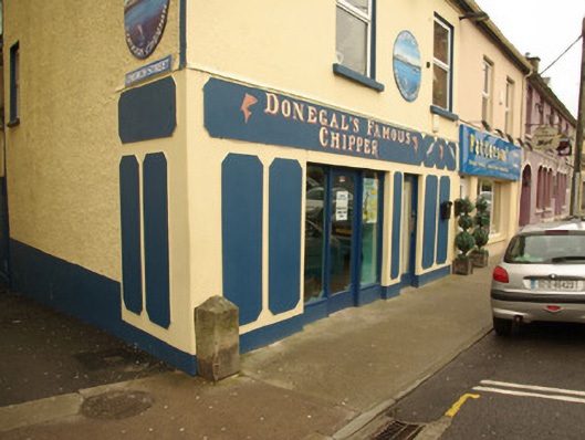
Description
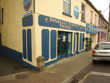
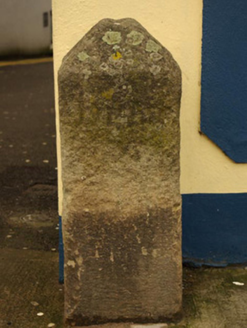
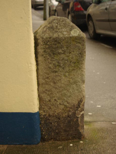
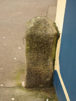
Freestanding granite milestone on rectangular-plan, erected c. 1780, having pyramidal head. Inscriptions to the east and west faces now illegible. Located adjacent to corner of building on footpath at the junction of Upper Main Street and Church Street, and to the east of Donegal Town centre.
Appraisal
This milestone makes an attractive, if subtle, historical impression in the streetscape to the east of Donegal Town centre. Unfortunately the inscriptions are now illegible but the distance would have been in ‘Irish Miles’, which are longer than the standard mile measurement used today. It probably dates to the late eighteenth-century or to the first decades of the nineteenth century, a period when the Grand Juries were responsible for a great deal of improvement in the road transport network throughout Ireland, particularly the development of a series of ‘turnpike roads’ (from 1729) on which milestones are usually found. Milestones appears to be marked along this road on the Taylor and Skinner road maps of 1777 – 1783, although there were no turnpike roads in Donegal before 1805. This simple item of street furniture acts as a subtle historical reminder the great coach travel in Ireland, and is an integral element of the built heritage of the local area. It may have been moved from a site very close to its present location in recent years.