


Survey Data
Reg No
40839014
Rating
Regional
Categories of Special Interest
Architectural, Technical
Original Use
Bridge
In Use As
Bridge
Date
1780 - 1790
Coordinates
220497, 393884
Date Recorded
02/04/2008
Date Updated
--/--/--
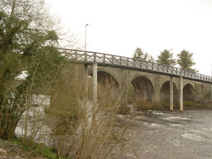
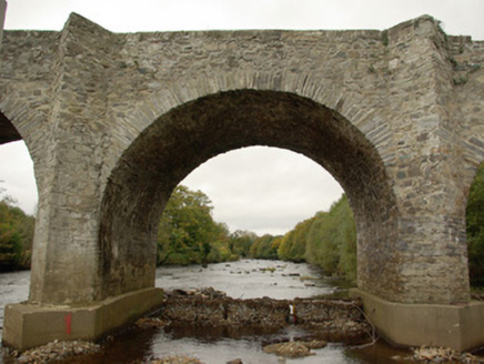
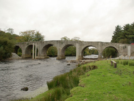
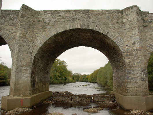
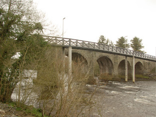
Description
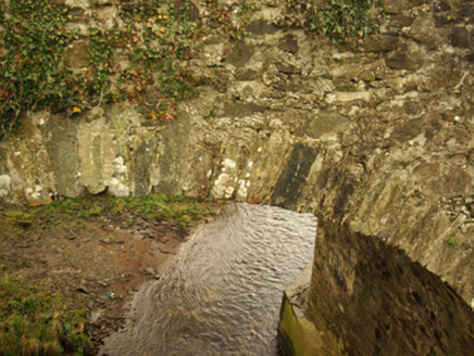
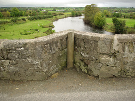
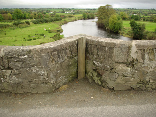
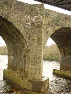
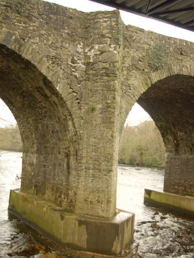
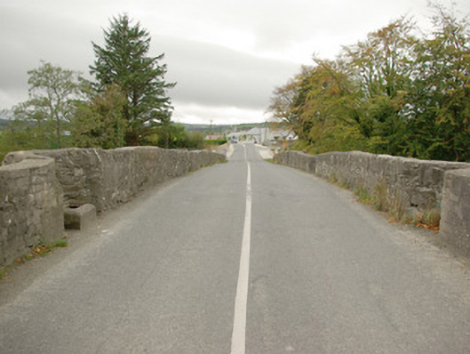
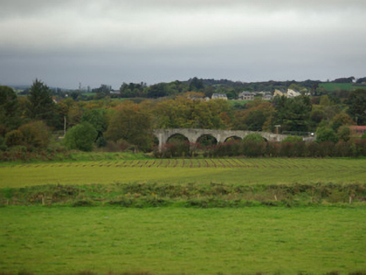
Seven-arch bridge carrying road over the River Finn and former millrace, built c. 1782, and having V-profile rubble stone cutwaters to piers to both upstream and downstream elevations rising to pedestrian refuges over at parapet level. Bridge rises from each end (south-west and north-east) to the centre. Modern concrete underpinning to base of piers. Segmental-headed arches having rubble stone voussoirs; rubble stone construction to piers and to arch barrels. Rubble stone construction to parapets and spandrels; rubble stone wing walls to either ends of parapets. Tarmacadam deck. Modern pedestrian bridge runs parallel adjacent to the south-east elevation. Located to the south\south-east of Killygordon, and to the north-east of Crossroads.
Appraisal
This imposing and elegant bridge, of late eighteenth-century date, retains its early character and form, and is an appealing feature in the rural landscape to the south of Killygordon. It is robustly-constructed in good quality local rubble stone masonry, and its continued survival and use stands as testament to the quality of its original construction, and of the skill of the masons involved. The relatively narrow plan, rubble stone construction, and the V-shaped cutwaters to piers that rise to form pedestrian refuges over are all indicative of its early date. This bridge also rises to the centre, which is a feature of a number of eighteenth century multiple arched bridges in Ireland. This bridge originally dates to the late-eighteenth century, a period that saw a great deal of road and bridge-building in Ireland, particularly by the Grand Juries (the forerunners of the County Councils) - a bridge is depicted here on the Taylor and Skinner map of the area from 1777 – 1883, though not on Moll’s map dated 1714, which suggests that it dates to between these dates. According to some sources (including Ordnance Survey Memoirs), this bridge was originally built in 1782 at a cost of £1,120, raised by 'by assessment from the county' [Grand Jury Assessment]. It also crosses (to the south-west end) a former millrace associated with now demolished corn, flour and tuck mill(s). This bridge probably replaced a ford to site or close to site. This bridge is one of a number of fine bridges over the River Finn, and is an important element of the built heritage and transport history of County Donegal.