


Survey Data
Reg No
40823065
Rating
Regional
Categories of Special Interest
Architectural, Scientific
Original Use
House
Date
1740 - 1780
Coordinates
222774, 421148
Date Recorded
25/06/2014
Date Updated
--/--/--
Description
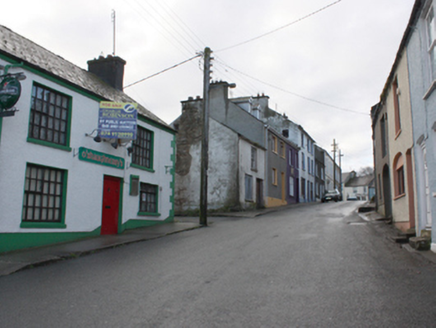
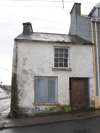
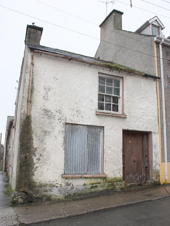
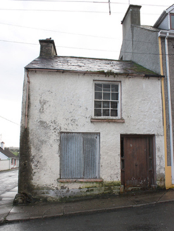
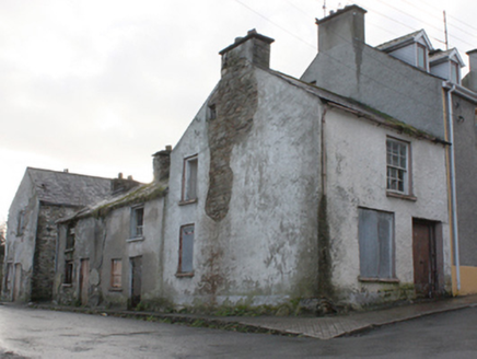
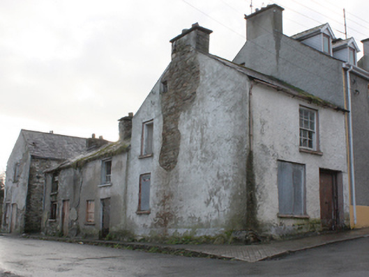
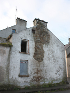
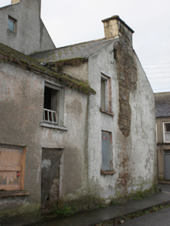
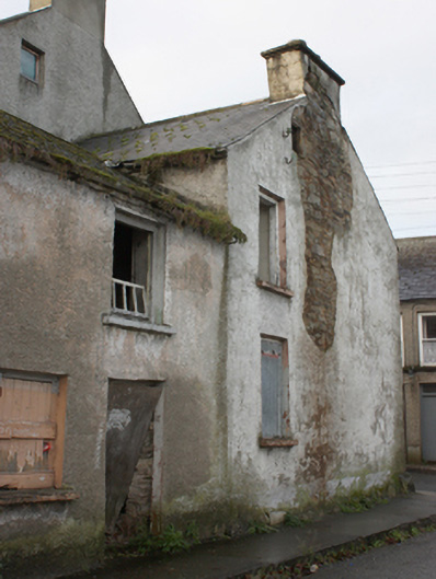
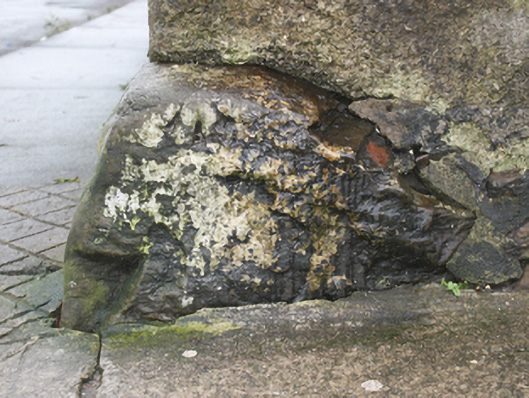
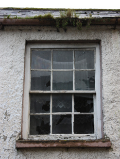
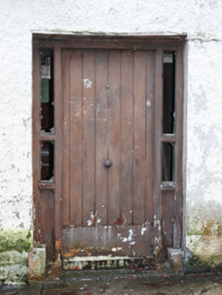
Corner-sited attached two-bay two-storey house with attic level, built c. 1760, having two-bays to the front elevation (north-west) at ground floor level with single-bay over at first floor level. Currently disused. Pitched natural slate roof to the front pitch (north-west) having projecting rendered cut stone eaves course, clay ridge tiles, roughcast rendered rubble stone chimneystack to the north-east gable end, and with surviving cast-iron rainwater goods. Roughcast rendered rubble stone walls, slightly battered to the north-east corner with projecting boulder\stone having incised Ordnance Survey benchmark to top; projecting plinth to the front elevation (north-west). Square-headed window openings having smooth rendered reveals, some surviving stone sills, and with six-over-six pane timber sliding sash window to the front elevation at first floor level, blocked windows to the front elevation and to the north-east side elevation at ground floor level, square-headed window opening to the north-east side elevation at first floor level (fitting now missing), and with square-headed window opening over at attic level having two-over-two pane timber casement window. Square-headed door opening to the south-west end of the front elevation (north-west) having stone plinth blocks, smooth rendered reveal, battened timber door, and with narrow sidelights over timber panels. Road-fronted to a corner site to the north-east end of the historic centre of Ramelton.
Appraisal
Although now out of use and dilapidated, this modest corner-sited house retains its early form and character. Its visual appeal and integrity are enhanced by the retention of salient fabric such as the natural slate roof, battened timber door and timber sliding sash windows, albeit in a sadly dilapidated condition. The irregular-spacing and sizing of the openings, the rendered unrefined rubble stone construction, the battered cornet the north-east, small window opening at attic level, and the projecting plinth\base to the north-west elevation, all suggest an early date, perhaps dating to the mid-eighteenth century (if not earlier). Its vaguely vernacular form contrasts with the more formal architecture aligning The Mall to the south-west. It occupies a site to the north-east end of the centre of the historic town of Ramelton, which was established during the Plantation era in the early decades of the seventeenth century. It appears to have formed part of a terrace of houses in single ownership with buildings formerly adjoining to the south-west (Griffith’s Valuation map of 1860) that may have originally been in use as worker’s houses; these buildings are now demolished. The Ordnance Survey benchmark to the projecting boulder to the north-east probably dates to the originally surveying of the town in 1834, adding some scientific interest. Prominently-sited at a corner site to the north-east of the centre of Ramelton, this house is an integral element of the built heritage of this historic town. If sensitively restored, it would make a strongly positive contribution to the streetscape of this fascinating town.