


Survey Data
Reg No
13401922
Rating
Regional
Categories of Special Interest
Architectural, Artistic, Social
Original Use
Church/chapel
Date
1800 - 1840
Coordinates
223349, 265066
Date Recorded
18/07/2005
Date Updated
--/--/--
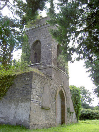
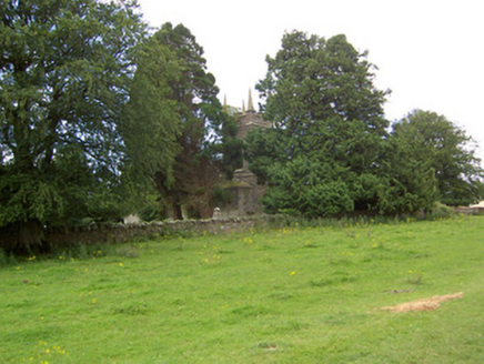
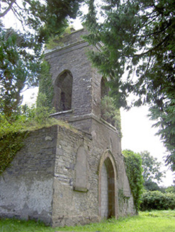
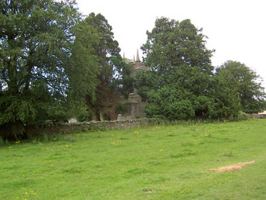
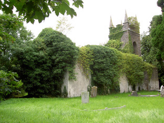
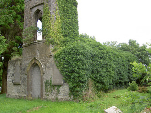
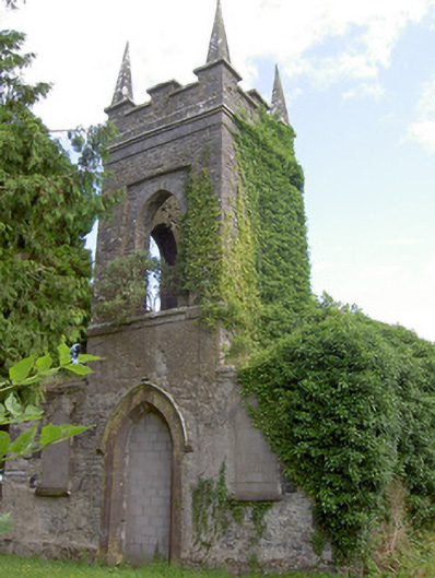
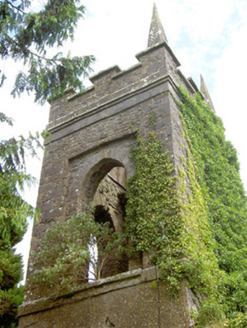
Description
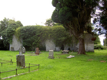
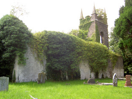
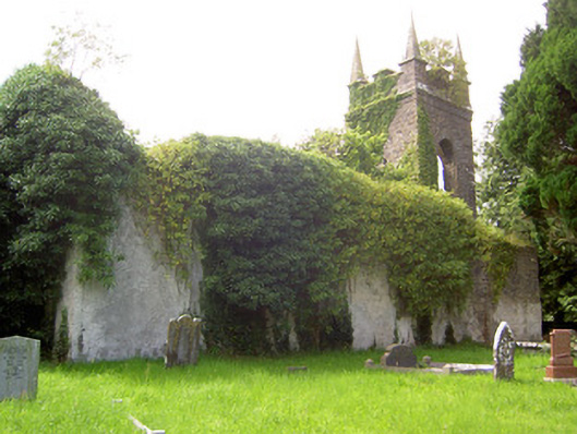
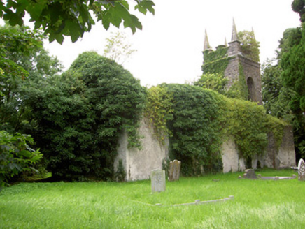
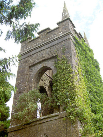
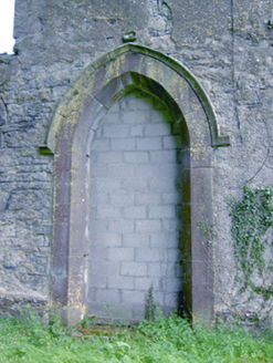
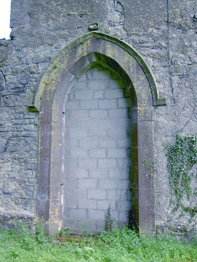
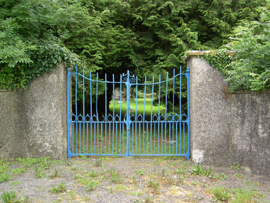
Freestanding former Church of Ireland church, built c. 1814 and altered c. 1860, having three-bay nave elevations (openings blocked), two-stage bell tower (on square-plan) to the northwest gable having flaking single-bay vestibules to either side (southwest and northwest) and apse to the chancel gable (southeast). Now roofless and disused. Largely overgrown with ivy. Roof now collapsed/removed, formerly pitched over nave and hipped over apsidal chancel. Roughcast render over roughly coursed limestone walls. Chamfered limestone plinth course to side vestibules. Crenellated parapet with cut stone coping over and carved ashlar limestone corner pinnacles (on square-plan) to bell tower. Projecting dressed limestone string course and eaves course to tower. Pointed arch window openings to front face of side vestibules having roughly dressed limestone voussoirs and dressed sills, now infilled with breeze block construction. Openings to side elevations of nave and to chancel now infilled and/or obscured by vegetation. Pointed arch openings to tower at belfry stage (second) having roughly dressed limestone voussoirs, opening to front elevation (northwest) set in blind square-headed recess. Fittings now gone. Pointed arch door opening to front face of tower (northwest) having chamfered limestone surround with carved limestone hoodmoulding over, now infilled with breeze block construction. Set back from road in own grounds to the southeast of Ardagh and the northwest of Legan. Surrounded by graveyard with collection of recumbent, upstanding and box-type grave markers dating to the nineteenth and twentieth century. Pebbledashed rubble stone boundary wall to road-frontage to the northeast, rubble limestone boundary walls elsewhere to site. Main entrance gateway to the northeast comprising a pair of pebbledashed gate piers (on square-plan) having cut limestone capping and double leaf wrought-iron gates. Associated rectory (134019201) adjacent to the southeast.
Appraisal
Although now derelict and roofless, this small-scale single-cell Church of Ireland church retains its early character and form. The now-blocked pointed arch openings lend this building a muted Gothic theme. The form of this church conforms to typical Board of First Fruits (1711 - 1833) two/three-bay hall and tower form that can be found in great numbers throughout the Irish countryside. It retains good quality cut and dressed stone detailing, particularly to the tower and to the main doorway. The prominent corner pinnacles to the tower help create a striking silhouette and a strong presence in the rural landscape to the southeast of Ardagh. The side vestibules, flanking the tower, are an interesting feature that are found at a number of Church of Ireland churches in County Longford, including those at Ardagh (13312032) and at St. Munis Church of Ireland church (13402721), at Forgney. It was built at a cost of £989 (Irish Parliamentary Returns 1837), and Lewis (1837) records that this church (at Kilglass), ‘a plain building with a square tower, was erected in 1814, for which the late Board of First Fruits granted a loan of £368. It was altered in 1860 (IAA) by the Ecclesiastical Commissioners (1833 – 1870), and it is possible that the apse was added at this date (map information). The wall monuments to the interior of this church were moved to St. John’s Church of Ireland church (13309011), Edgeworthstown, c. 1990. The collection of stone grave markers to site, some of artistic merit, add to the setting and context of the churchyard. Recessed from the road behind simple but well-built boundary walls, this church and its graveyard, together with the former rectory (13401921) to the southwest, form an interesting group of Church of Ireland structures set in a pleasantly matured landscaped site. The well-crafted wrought-iron gates to the main entrance add additional interest along the roadscape. There was formerly a school house (Ordnance survey six-inch map sheets 1838 and 1913) and a parochial hall (Ordnance survey third edition six-inch map sheets 1913, possibly the earlier school house converted to a new use) to the southeast of the church, now no longer extant.