| Initial Overview | |
|---|---|
| Site Footprint Visible | No |
| Boundary Defined | Yes |
| Significant Development | Yes |
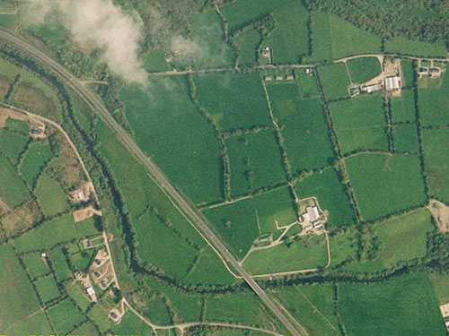
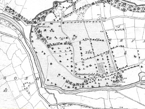
| General Comments | The principal drive shown on the 1836 - 1846 OS map has been developed into a major road. A significant number of modern agricultural buildings have been constructed in the core landscape. |
| Architectural Features | |
|---|---|
| Principal Building | No |
| Garden Structures | No |
| Gateways and Gatehouses | No |
| Buildings of Indeterminate Purpose | No |
| Movement Within Site | |
|---|---|
| Entrances have changed | Yes |
| Drive position has changed | Yes |
| Avenues | No |
| Woodland Drives or Walks | No |
| Landscape Features | |
|---|---|
| Woodlands | No |
| Orchards | No |
| Parkland | No |
| Formal Garden | No |
| Kitchen / Walled and Productive Gardens | No |
| Vistas | No |
| Allees | No |
| Natural and Naturalistic Water Features | Yes |
| Artifical Water Features | No |
| Other Features | No |